Lake Winnipeg Exhibit Nears Opening

Lake Winnipeg Exhibit Nears Opening

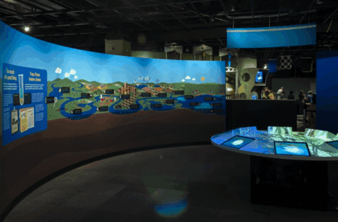
It’s nearly here, the culmination of five years of thought, research, design work, programming, and development. Lake Winnipeg: Shared Solutions (LWSS) opens on World Water Day, Saturday, March 22, 2014. It’s been a long process, and I still have to pinch myself to realize that we actually built this thing. It’s amazing to work on a project that is mostly spreadsheets and line drawings for so long, and then in a few short weeks have it sprout up all around you like a grove of new trees.

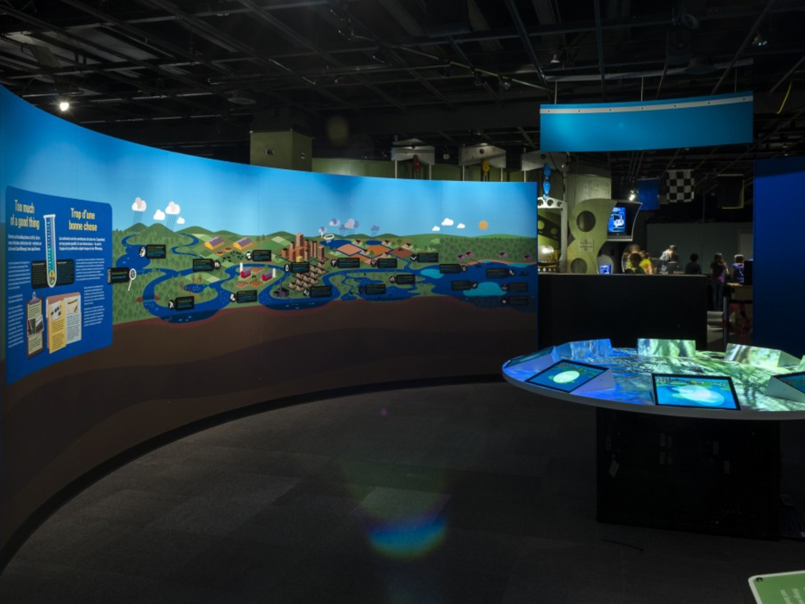
The Lake Winnipeg Shared Solutions exhibit in the Manitoba Museum Science Gallery. On the left, a curving divider wall displays a mural through the journey of water. On the right, a round table glows from eight embedded tablet screens.

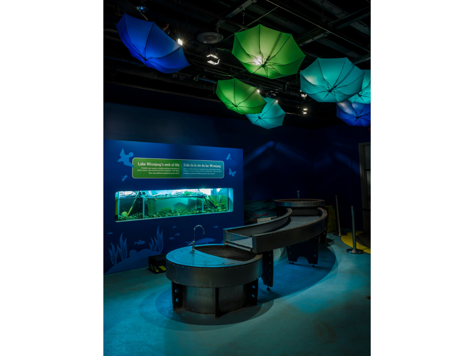
A sloping water table in front of a wall-embedded fish tank. Above the area blue and green umbrellas hang upside-down, lit by spotlights in the ceiling.

You can get a sneak preview of the exhibit when CTV’s morning show visits on Thursday, March 20, and again on Friday the 21st when Global has their morning show at the Museum. Of course, the best way to see the exhibit is to come on down – as part of the Science Gallery’s permanent exhibits, LWSS is free for Museum Members and reasonably priced for everyone.

Scott Young

Scott Young

Planetarium Astronomer

Scott is the Planetarium Astronomer at the Manitoba Museum, developing astronomy and science programs. He has been an informal science educator for thirty years, working in the planetarium and science centre field both at The Manitoba Museum and also at the Alice G. Wallace Planetarium in Fitchburg, Massachusetts. Scott is an active amateur astronomer and a past-President of the Royal Astronomical Society of Canada.

Chris Kelekis and His Family Restaurant

The C. Kelekis Restaurant, a Winnipeg icon renowned as one of the finest diners on the prairies, closed in 2013 after 81 years of service. Located on Main St., it was an eatery that provided more than just good fries: there was always a chance you would meet a friend. The founder of the restaurant was Chris Kelekis (1886-1957). He immigrated from Triglia, a Greek settlement in Turkey, in 1913 following his beloved Magdeline Alaglou, who came with her brother and sister-in-law. After first living in Montreal, Chris and Magdeline moved to Winnipeg in 1918 and eventually had eight children, all of whom were involved in the restaurant in one way or another.

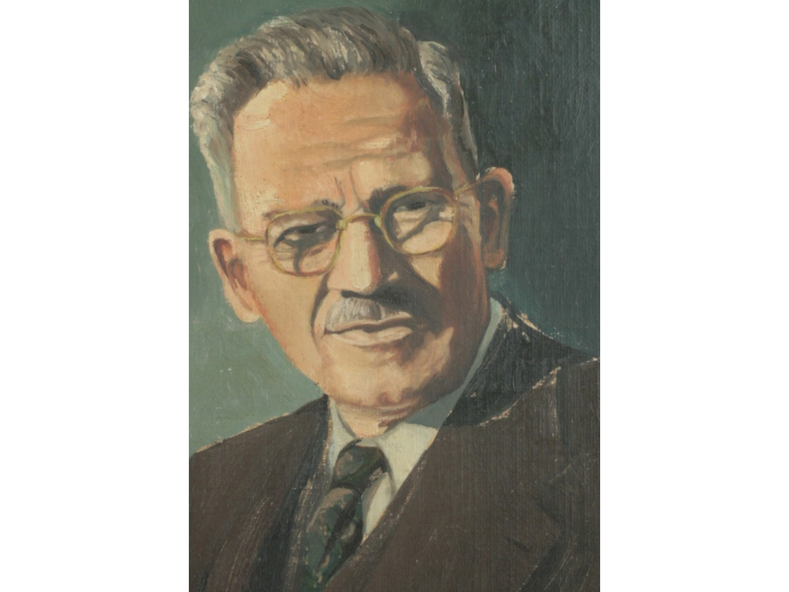
Close-up on the face in an oil-portrait of an older man with glasses and a moustache wearing a suit and tie.

Chris (originally Chrystomis) first pushed a cart selling peanuts and popcorn at various events, and eventually sold chips from a Model T Ford truck, on the same spot where the restaurant was eventually located in the early 1940s, 1100 Main St. It was expanded in 1955, and the rest is history.

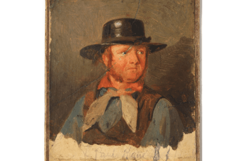
A year ago the Kelekis family donated a number of items from the restaurant to the museum, including a collection of dinner ware, their well-used toaster, a framed print of Queen Elizabeth II that had been on the wall since the 1950s, and a menu (also from the ‘50s). A painting of Chris Kelekis, featured here, was also donated.


Image: Oil portrait of Chris Kelekis, date unknown. The Kelekis family had asked for a photograph of their father to be enlarged by a Winnipeg photography studio. As a surprise gift for a family the studio commissioned an artist to paint this portrait based on the photograph. Painting H9-38-85. Copyright The Manitoba Museum.

Thank you to the Kelekis family for the good food, the memories and the donation of artifacts.

Dr. Roland Sawatzky

Dr. Roland Sawatzky

Curator of History

Roland Sawatzky joined The Manitoba Museum in 2011. He received his B.A. in Anthropology from the University of Winnipeg, M.A. in Anthropology from the University of South Carolina, and Ph.D. in Archaeology…
Meet Dr. Roland Sawatzky

Diorama Details

By University of Winnipeg student Kristina Misurska


Hello, everyone! Kristina’s blog post for this week is going to be a bit different than some of her other posts:

Over Reading Week I went to a conference in Albuquerque, New Mexico, so I didn’t start any new research. Most of my work since my last blog post has been focused on continuing to figure out what is going to be involved with the QR code project, so I thought I would instead take this opportunity to blog a bit about the diorama itself.

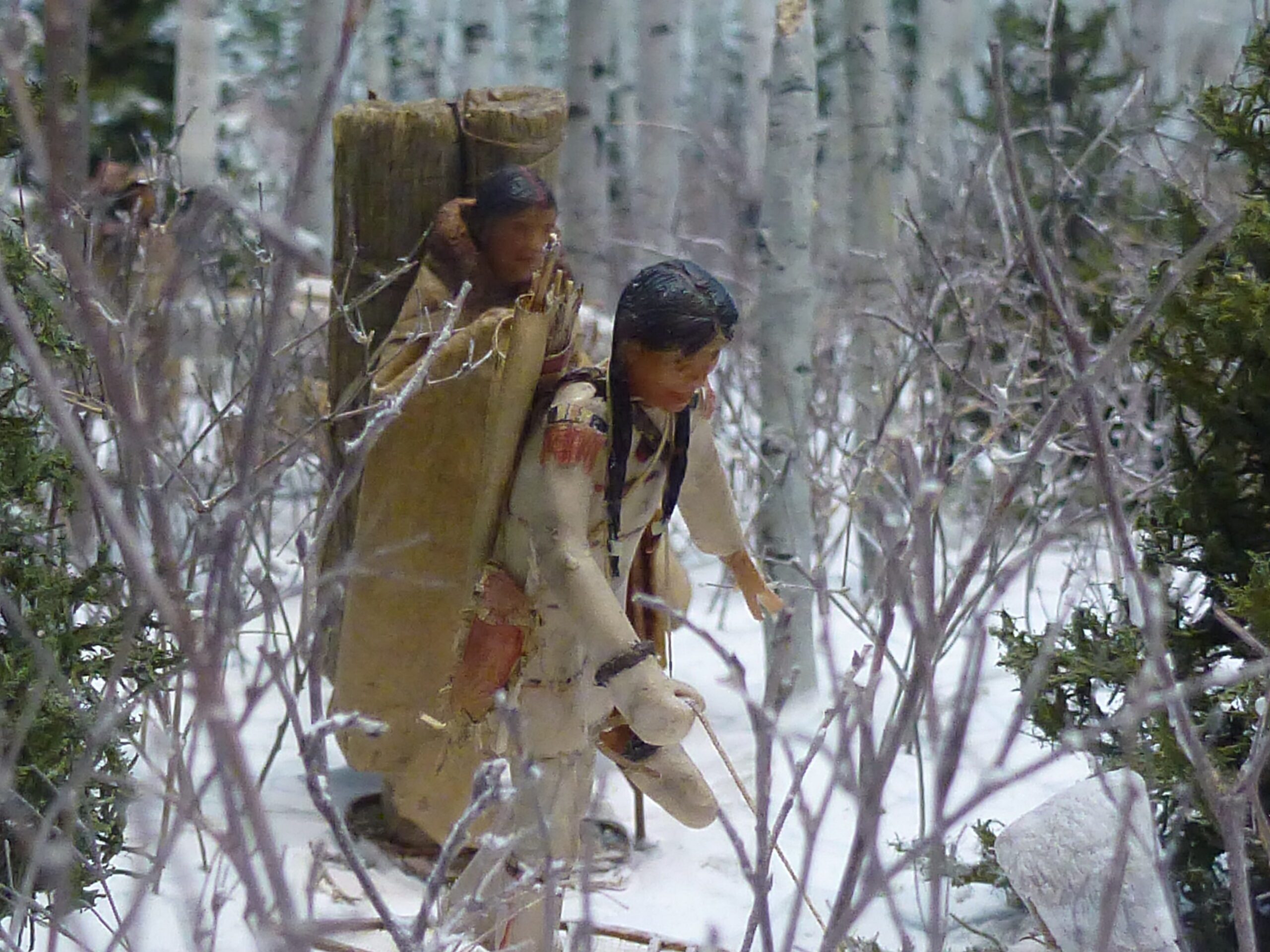
Two figures in a miniature diorama winter scene, wearing traditional winter gear and with bundles on their backs.

The diorama is an astounding piece of work. Betsy Thorsteinson, an extremely talented artist, along with her skilled group of volunteers, put an incredible amount of detail into the diorama. The result of all their hard work is a diorama that, from afar, looks as if it could be a photograph of a real-life fishing camp. Taken as a whole, the diorama is beautiful.

To fully appreciate the amount of effort that went into the creation of the display, however, it helps to take a closer look. To that end, two separate monocles, or monoculars, are provided with the diorama so that visitors can get a close-up view of some of the details. The monocle lets viewers zoom in on different areas and see food being prepared in pottery vessels, birds flying amongst trees, and fish being smoked over fires.  The monocles help to focus on the thought and precision that went into the display. From the figurines of the family, to the branches of the trees, to the smoke rising from the campfires, every detail tells a story.


Image: Closeup of winter travelling scene, Aschkibokahn Diorama

The monocles help visitors to zoom in on areas that make them curious. This parallels what I am hoping to accomplish with my project –  to give visitors the option of learning more about the present-day site, along with seeing the bigger picture of the site.

That’s all for this week! Please check back next week to see how my project progresses.

Where the Dead Things Are

Recently, Melissa Pearn, our Cataloguer of Natural History collections went on maternity leave. She wrote this blog entry before she left.


As a Natural History cataloguer, I have the opportunity to work with some very interesting specimens. I love that my job involves all three areas of natural history – botany, zoology (mostly entomology), and palaeontology/geology. Having studied pollination and reproduction of Lady’s Slipper orchids for my Master’s thesis, I especially enjoy working with the botanical and entomological specimens. It’s fascinating to get to see some of the plants and insects that I have heard or read about, but have never had the opportunity to see in nature.

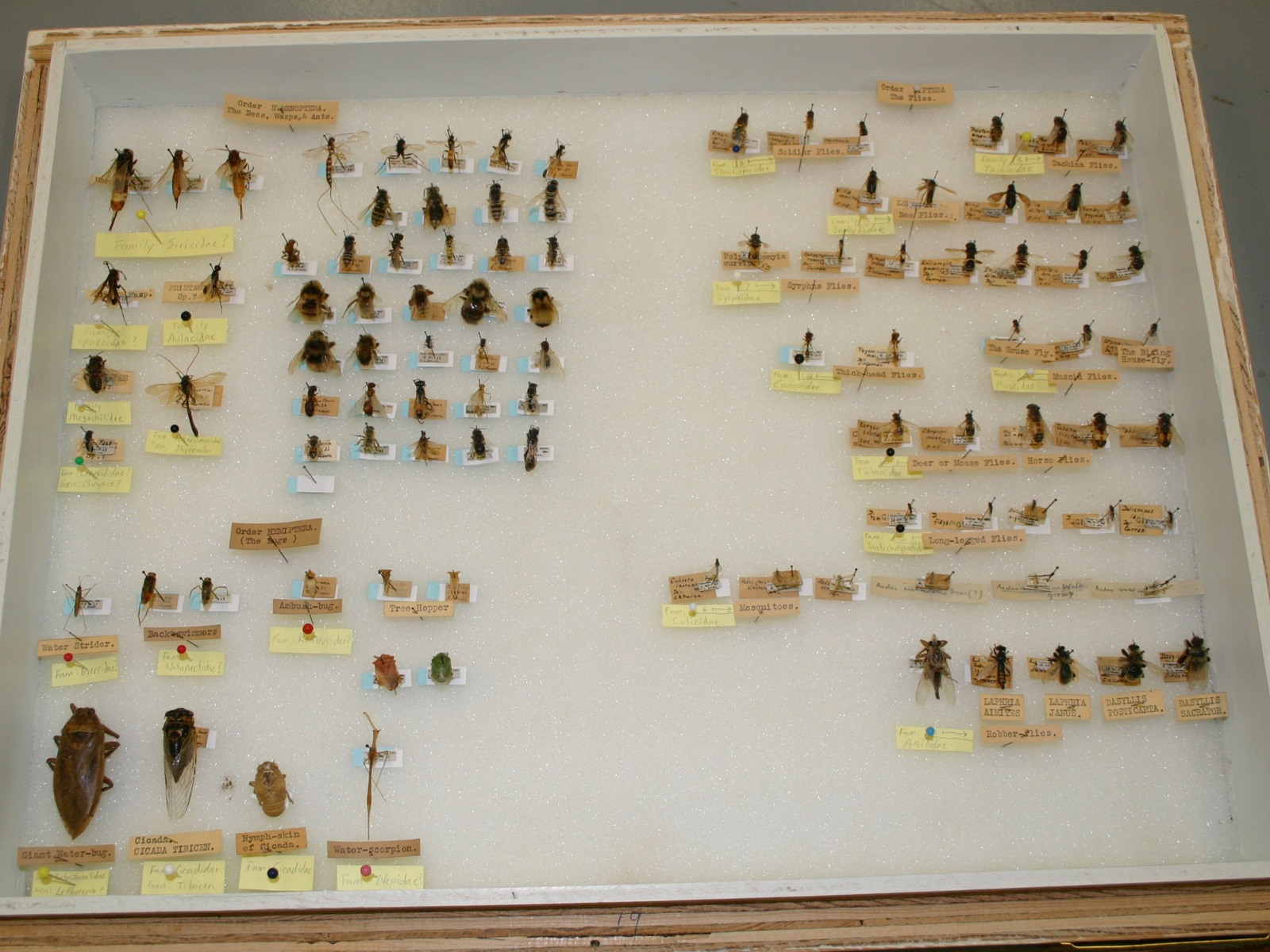
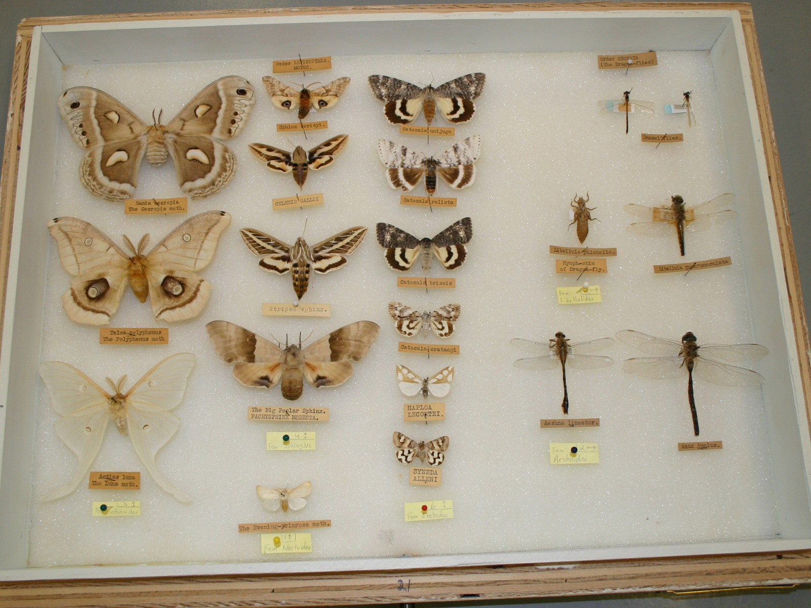
I’ve recently been cataloguing an interesting collection of Manitoba insects. The specimens were collected in the 1920’s and 1930’s, in places such as Victoria Beach and Winnipeg (especially Transcona). Not only is the collection fascinating because of its age and local origins, but also because of its diversity. Many of the specimens belong to the Lepidoptera (moths and butterflies), but the collection also includes insects from 11 other groups such as Hymenoptera (ants, bees, and wasps), Coleoptera (beetles), Diptera (flies), Hemiptera (the true bugs), and Odonata (dragonflies), among others.

The collection was assembled by Manitoban naturalist and entomologist George Shirley Brooks. He was born in Wrentham, Surrey, England in 1872 and came to Manitoba around 1913. He was not only a founding member and president (1932-1934) of the Natural History Society of Manitoba, but also co-founder of The Manitoba Museum and author of “Checklist of the Butterflies of Manitoba”. He died in Winnipeg on October 20, 1947 and is buried at Brookside Cemetery.

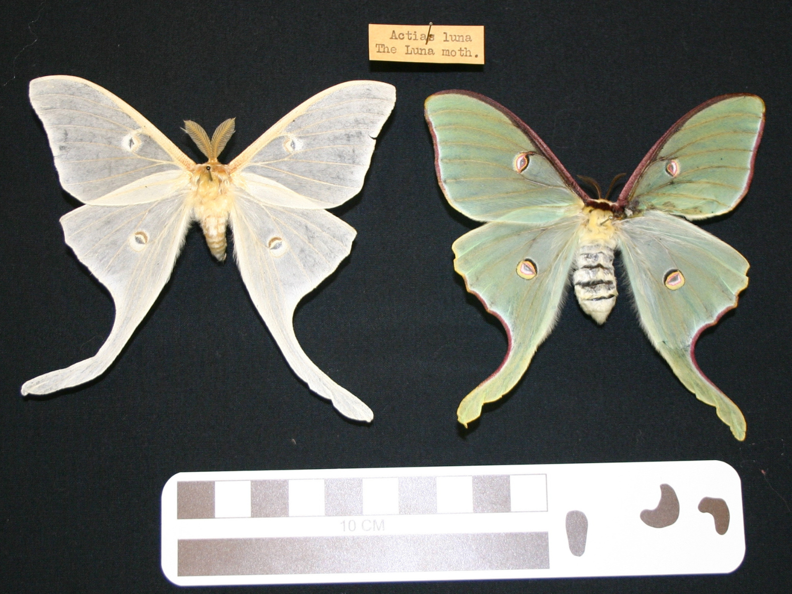
Older collections such as this one are very valuable for the information that they contain. Because many specimens have a collection date and location, they can help researchers to evaluate and determine population trends over time, or to determine the status of rare species for example. In order to maintain the integrity of these types of collections, proper storage and handling are very important. In Natural History, specimens are stored in a collections room that is controlled to create just the right temperature, light, and humidity conditions. Under less than ideal conditions, or when on display for long periods of time, specimens can become altered, as can be seen with the faded coloring of some of the moths and butterflies in the Brooks collection.

An open storage drawer containing a variety of pinned insect specimens.

Insect case with Hymenopterans (bees, wasps), Dipterans (flies) and Hemipterans (true bugs).

An open storage drawer containing a variety of pinned insects including moths and dragonflies.

Storage case with insect groups Lepidoptera (moths) and Odonata (dragonflies and damselflies).

Two pinned Luna Moths with distinct colouration differences. the wings of the moth on the left is faded nearly to white, whereas the one on the right has green wings.

Two Luna Moth specimens. Though approximately the same age, the one on the left has become severely faded.

NOTE: Melissa had a healthy baby girl on Feb. 3. She is named Ivy. The Museum staff wish her family all the best.

Another Water Exhibit in Development…

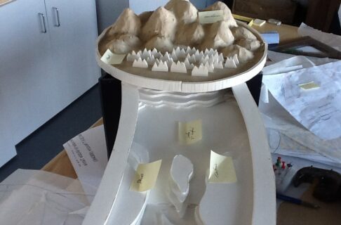
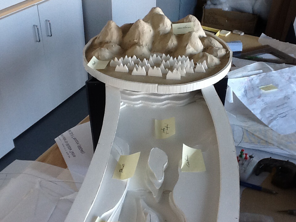
A concept model of a watershed table, where water will flow from the mountains on top down towards the camera.

As we put the finishing touches on Lake Winnipeg: Shared Solutions, we’re working on another water exhibit. Our stream table has been a popular fixture with the younger scientists, allowing them to experiment with flowing water and sand. Alas, sand and the new touch screens in Lake Winnipeg: Shared Solutions don’t mix, so the stream table was scheduled for decommissioning.

Don’t despair, though! Thanks to being slightly underbudget on some other expenses, we have been able to start working on Stream Table 2.0! Instead of sand, the table will have a complete watershed: a lake, several rivers, and a flood plain. Visitors will be able to block some channels, add vegetation and wetlands, and try to control the floods.

Here is an image of our scale concept model, built by diorama artist Betsy Thorsteinson. Enjoy!

Scott Young

Scott Young

Planetarium Astronomer

Scott is the Planetarium Astronomer at the Manitoba Museum, developing astronomy and science programs. He has been an informal science educator for thirty years, working in the planetarium and science centre field both at The Manitoba Museum and also at the Alice G. Wallace Planetarium in Fitchburg, Massachusetts. Scott is an active amateur astronomer and a past-President of the Royal Astronomical Society of Canada.

Lake Winnipeg Exhibit Takes Shape!

Today is Day One of the installation of the Science Gallery’s new exhibit, Lake Winnipeg: Shared Solutions! Lake Winnipeg is one of the most endangered lakes in the world, due to its huge watershed – water from four provinces and four U.S. states, from as far as the Rockies, flows into our Lake, carrying nutrients and pollution from cities, farms and industries. This state-of-the-art exhibit allows visitors to explore our local Great Lake and try to find solutions to this pressing problem. The exhibit features a high-tech lake simulator, the Watershed of the Future, which lets visitors take control of the decisions that affect the lake’s health. Do we improve the city’s sewer systems, or look for better ways to fertilize crops? You decide! The Watershed of the Future is based on information provided by dozens of scientists and industry experts, and shows not only the effect of your decisions on the Lake’s health, but also on the economy and the quality of life of Manitobans. The exhibit also features a live Lake Winnipeg ecosystem, natural history specimens, satellite imagery, and information on how you can do your part, at home or work, to help save our Lake.

We’ll be posting behind-the-scenes images and commentary as the exhibit is installed, so you can peek behind the curtain and see how the magic happens here at The Museum. The exhibit is scheduled to open on World Water Day, Saturday, March 22, 2014!

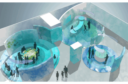
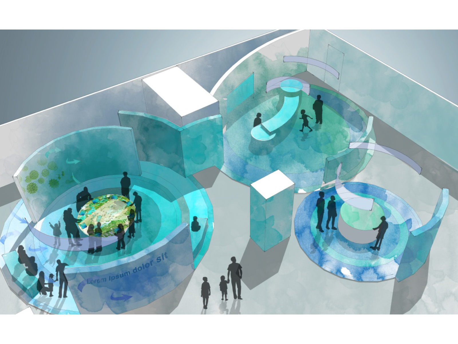
An artist's rendering of a three-part exhibit containing a digital activity, a watershed table, and an interactive station.

A early overview of the Lake Winnipeg: Shared Solutions exhibit.

A grainy photo looking over a low half wall with three porthole windows towards a sloping watershed table, and a brightly illuminated rectangle section of wall where a aquarium tank will be installed.

Lake Winnipeg Ecosystem going in. Live animals will reside here soon!

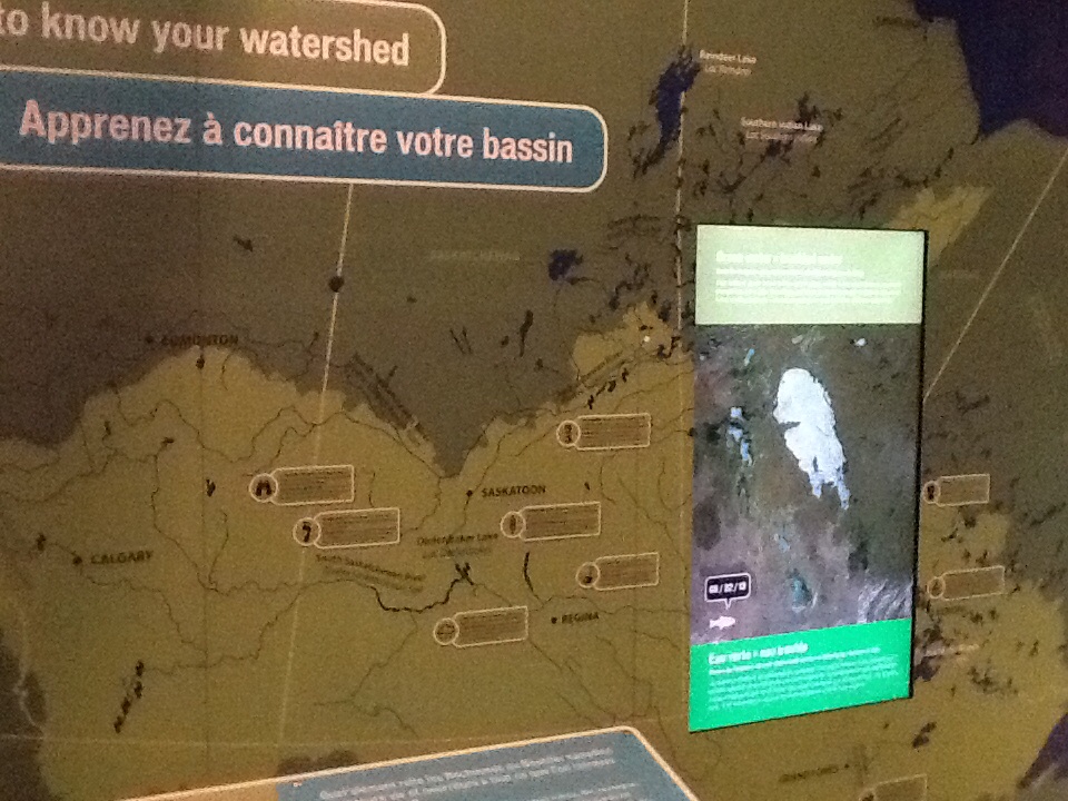
Close up on a Manitoba watershed map and digital touchscreen on an exhibit wall.

Satellite images of Lake Winnipeg are overlaid on a giant map of the watershed.

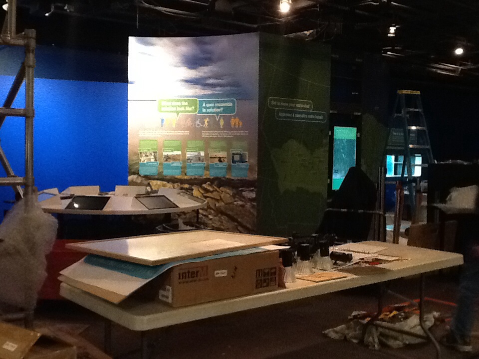
An exhiit under construction in the Manitoba Museum Science Gallery. A table holds boxes, papers, and tools in the foreground.

Installation continues.

Scott Young

Scott Young

Planetarium Astronomer

Scott is the Planetarium Astronomer at the Manitoba Museum, developing astronomy and science programs. He has been an informal science educator for thirty years, working in the planetarium and science centre field both at The Manitoba Museum and also at the Alice G. Wallace Planetarium in Fitchburg, Massachusetts. Scott is an active amateur astronomer and a past-President of the Royal Astronomical Society of Canada.

QR Code For Aschkibokahn Mini-Diorama

By University of Winnipeg student Kristina Misurska


Welcome back, everybody! This week Kristina’s post is a quick look at some of the behind-the-scenes planning that she’s been doing for her project:

As I mentioned in my last post, the goal of my project is to look at ways of linking the Aschkibokahn archaeological site and diorama with the present-day community of Duck Bay. The work I did this week involved looking at how to best integrate our research materials into the existing exhibit.

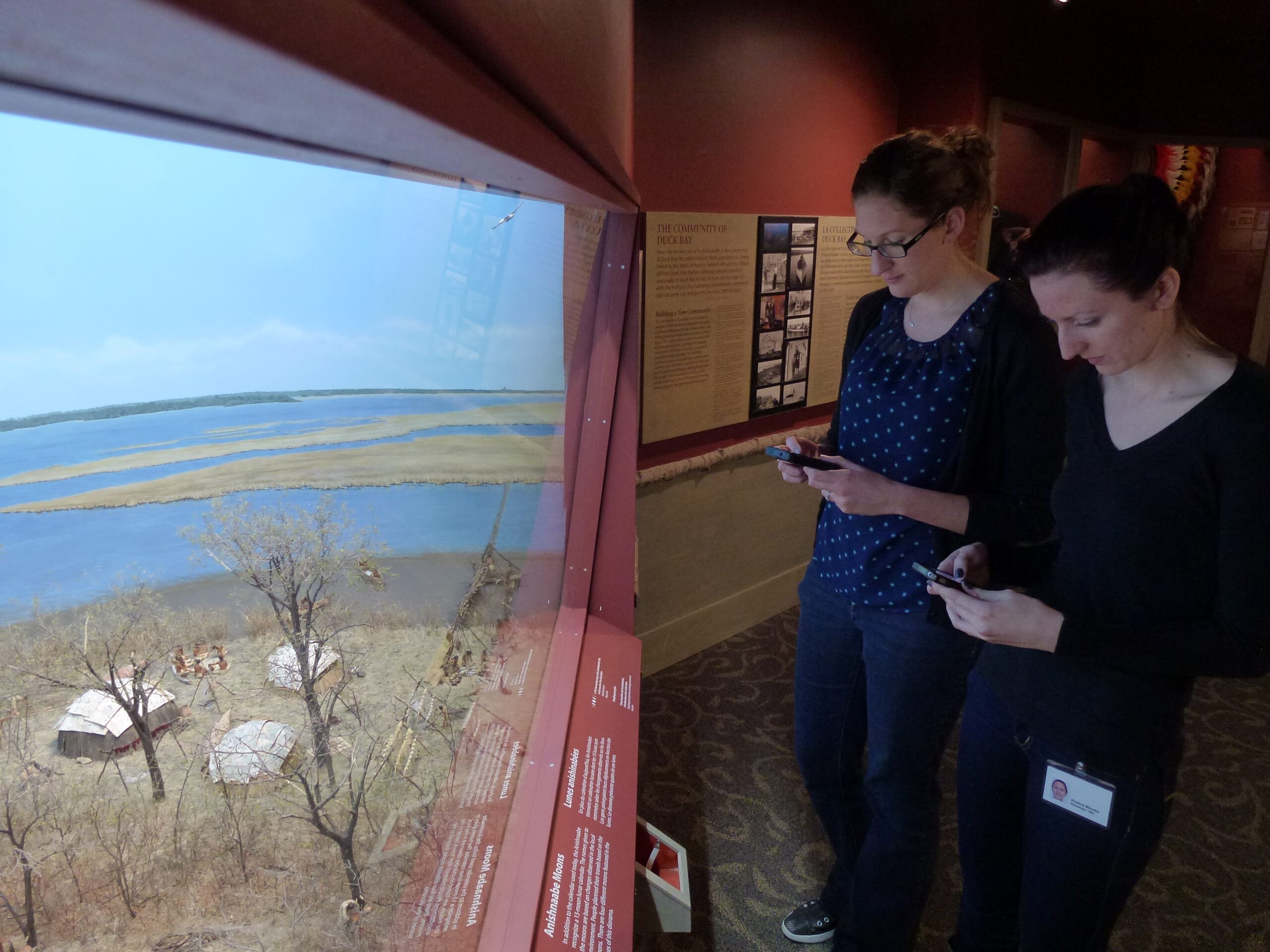
Two individuals each holding cell phones standing in front of the Aschkibokahn diorama in the Manitoba Museum's Lower Parklands Gallery.

One of the ideas we have come up with is to set up a QR code that links to a webpage with supplementary information about Duck Bay. Some of the materials we are hoping to share on this page include a poem written by Melba Sanoffsky, who grew up in Duck Bay, as well as photographs of the community through the years.

Before we can go any further we have to do something practical: ensure that smart phones are able to get reception in the exhibit area.  To check this, I visited the gallery with one of the curators. We have different service providers and we wanted to make sure we both had a signal and reception. We pulled out our phones, and success! Now we know it is possible to use QR codes in the exhibit area. The next steps will be to look at the materials we have at the museum, and to decide what else we would like to include in our web display.


Image: Kristina with Amelia Fay, Curator of the Hudson’s Bay Collection, checking web access at the Aschkibokahn mini-diorama.

At this point, the web page/QR code is just a concept. I will keep you informed as to what we actually come up with. Stop by the blog next week to see where I’m at with my project, and don’t forget to visit the new diorama!

Slicing the Onion

By Dr. Graham Young, past Curator of Palaeontology & Geology


A couple of weeks ago, I gave a presentation at McNally Robinson in Winnipeg, as part of our Museum lecture course Into the Vault. I was planning to talk about the ancient island shoreline deposits we have been studying in the Churchill area, and as I thought about history and pre-history, I was reminded of an observation I had made during an earlier trip to southwestern Manitoba. In most parts of a relatively flat landscape, the ground surface is the result of processes in the present day and the recent past; it is only where some of that surface is peeled away that we can really see evidence of a deeper past.

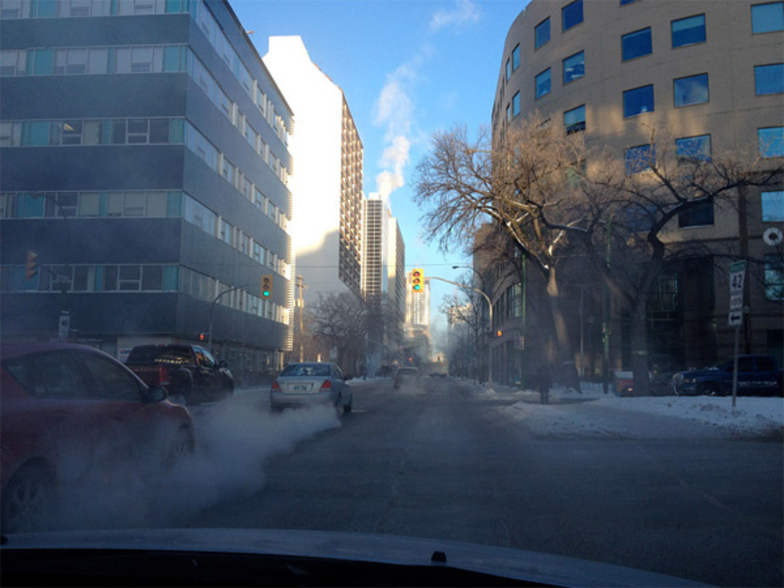
View down a downtown road between tall office buildings during winter. Under a blue sky there is snow along the sides of the road and leafless trees.

Downtown Winnipeg, as it has looked so often this winter.

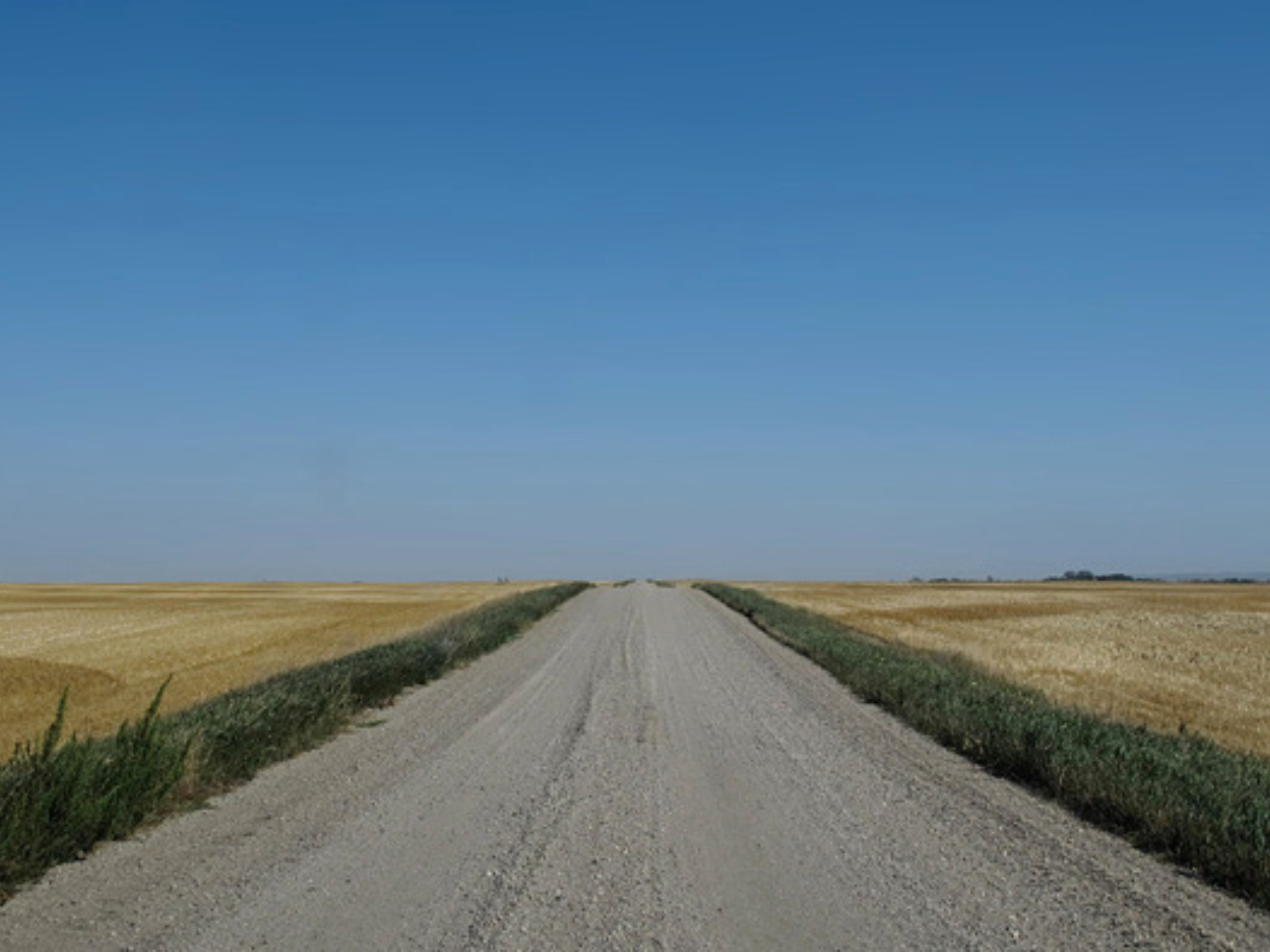
Looking down a gravel road under a clear blue sky. Yellow canola grows in fields either side of the road.

The endless horizon of a flat landscape in western Manitoba.

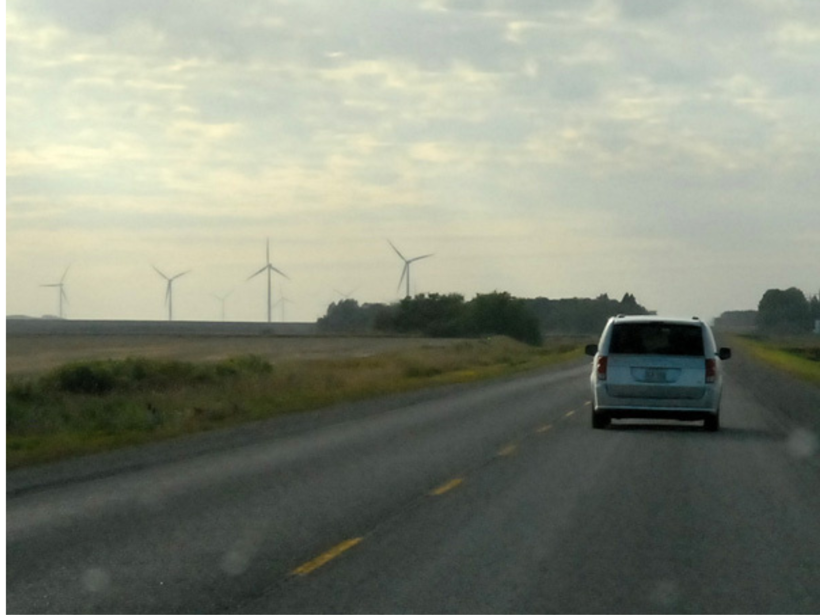
Photo taken from a moving vehicle on a single lane road. A vehicle drives in front, and in the distance, further in on the field, are three modern windmills.

Our modern landscape is different from all past landscapes.

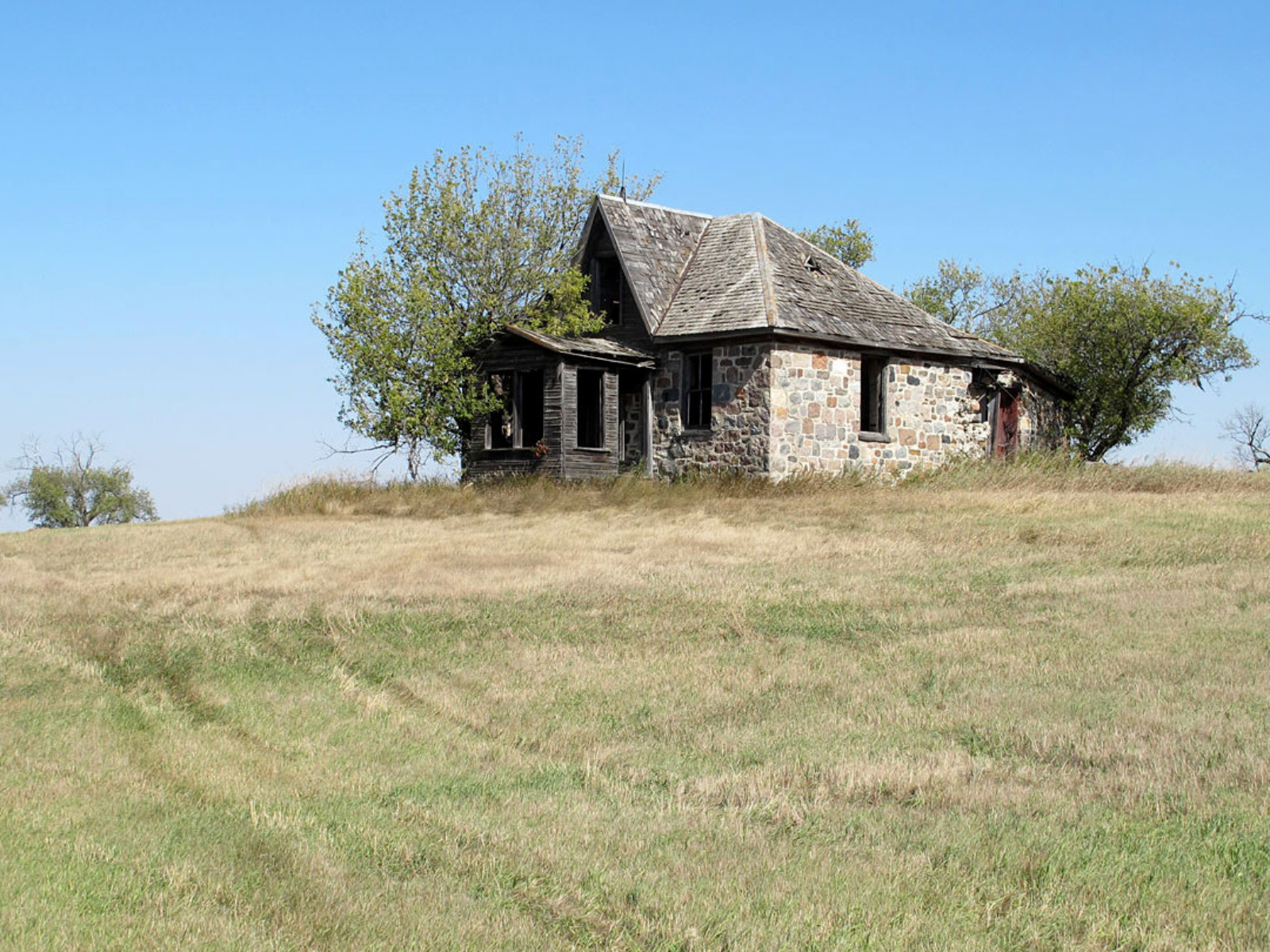
View up a gentle hill towards a now abandoned homestead built out of fieldstone.Overgrown bushes and trees grow close to the building.

On the surface, we can see evidence of the historic past: an abandoned farmhouse at Brockinton, Manitoba.

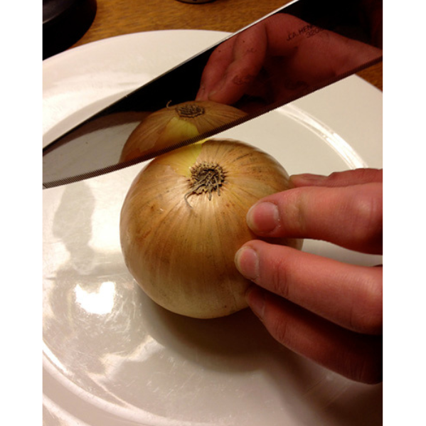
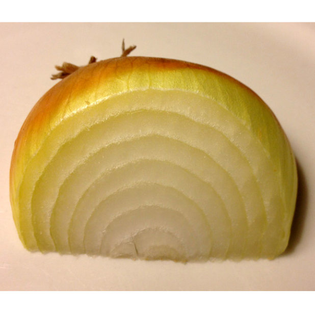
Where the earth is split open, along riverbanks and shorelines, and at roadcuts and quarries, we can see its older layers. While the surface usually represents the present, recent past, and relatively recent prehistory, the layers below that surface may be extremely old. Southwestern Manitoba and the Hudson Bay Lowland are both in the part of North America known geologically as the Platform, which has been free for a very long time from disruptive forces such as earthquakes and volcanoes. As a result, the layers are relatively orderly; the sediment was laid down almost horizontally, layer upon layer. Slicing through them vertically looks quite similar to slicing an onion with a knife.*

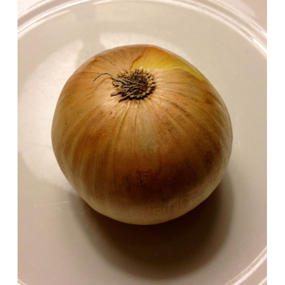
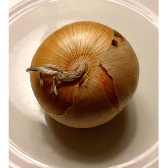
A whole onion upside-down on a plate.

A whole onion upright on a plate.

A whole onion on a plate with a hand holding a knife blade to the side of the onion in preparation of slicing.

A wedge of an onion sliced to show its many layers.

As we dig down into the upper surface of the land, below the historic remnants we can see evidence of prehistoric occupation of this region. Almost everyone is familiar with widespread artifacts such as arrowheads, but in some places in southern Manitoba we can see ancient burial mounds or traces of long-past hunting sites.

Elsewhere, the cuts in the Earth extend into older layers. Some of these layers are still made of sediment that has not been turned to rock, but they date from the late part of the Ice Age, before people are known to have lived in this part of the world.

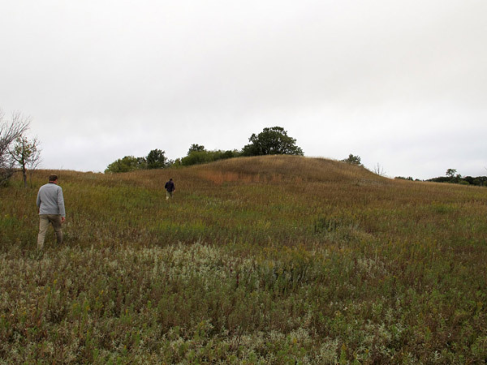
Two individuals trekking through tall grass towards a distinct mound in the land.

Calf Mountain, near Morden, is an ancient burial mound.

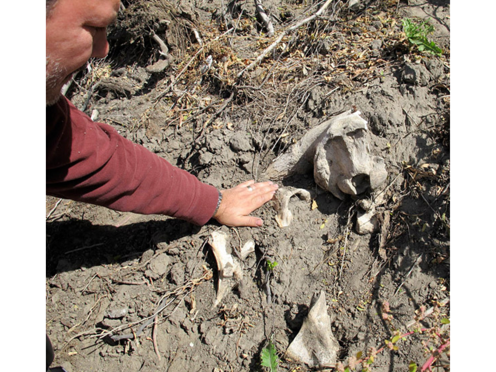
A person leans down into frame, reaching down towards bison bones embedded in the soil.

Kevin Brownlee examines bison bones at a hunting site dating from about 1200 years ago.

An individual stands beside a cut of ground beside a bank higher than themselves.

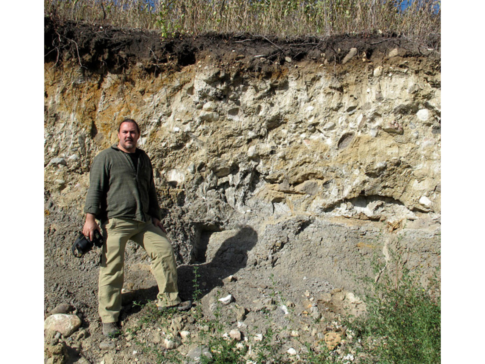
Near St. Lazare, Kevin looks at a cut bank is composed of till (sediment) deposited thousands of years ago by a glacier.

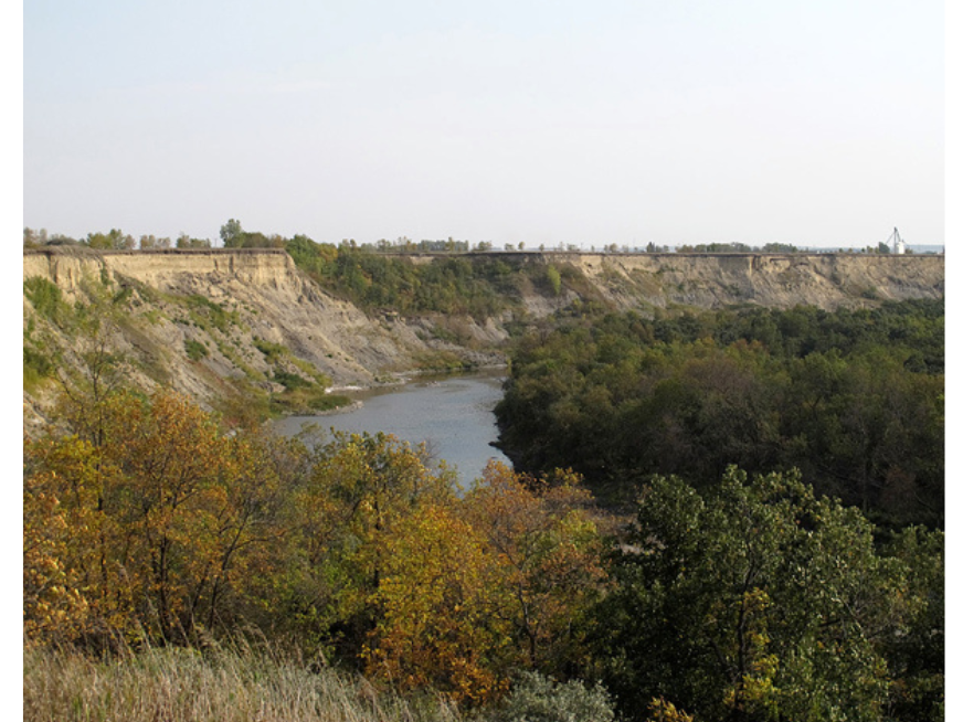
View towards a gorge with a river flowing through the centre. Green and yellow folliaged trees grow either side.

If the cut is deep enough, or if a high part of the bedrock reaches up to near the surface, we may see layers that date from long before the Ice Age. For example, along the Manitoba Escarpment there are many places where strata of Cretaceous age can be seen. These beds, dating from the later part of the age of the dinosaurs (roughly 100 million to 66 million years ago), are composed of shale and related rocks made of sediment deposited in the Western Interior Seaway.

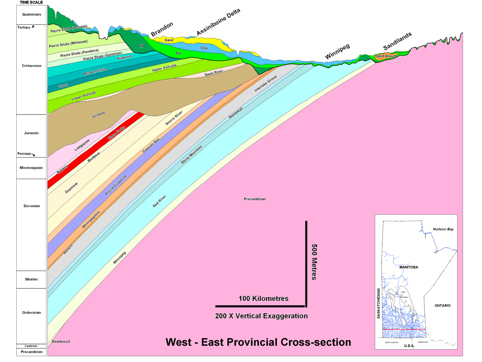
If you were to drill a vertical hole into the Earth anywhere in southwestern Manitoba, your drillbit would eventually pass down through the Cretaceous layers into successively older beds of Jurassic, Mississippian, Devonian, Silurian, and Ordovician age (see diagram below). Units of these ages are always in the same order, from youngest at the top to oldest at the bottom, thanks to the simple and straightforward law of superposition and principle of original horizontality. Basically, sediment layers deposited by water or wind tend to be close to horizontal due to gravity, and each layer is laid down on top of the older layers that are already present in an area.


Image: In the Wawanesa gorge of southwest Manitoba, the upper yellowish sediments are glacial and postglacial, while the lower grey ones are from the Late Cretaceous Period.

The geological time gaps in the Manitoba record (such as between the Mississippian and Jurassic rocks, where we might have expected deposits from the Pennsylvanian, Permian, and Triassic periods) simply represent intervals in which sediment was not being deposited in this region, and was perhaps being eroded.  Most of our sedimentary rocks were deposited under seawater; the intervals of deposition occurred at times when the sea invaded the middle of the continent, and the gaps in deposition represent times when the sea left this region. We are in the latter sort of situation nowadays, though of course sediment IS still being deposited in one part of the middle of North America: in Hudson Bay.

The layers in the diagram below look to be strongly tilted, but this is because the diagram has a 200x exaggeration of the vertical scale, relative to the horizontal. In reality, they are tilted just a few degrees. The tilt is related to their having been deposited on a seafloor that sloped gently toward the centre of the ancient sedimentary basin, which was located to the southwest.

A geological diagram slowing the layers of earth from west to east in Manitoba.

A west to east geological cross-section through southern Manitoba shows how the older strata are located below younger ones (vertical scale greatly exaggerated). (Image from the Manitoba Geological Survey).

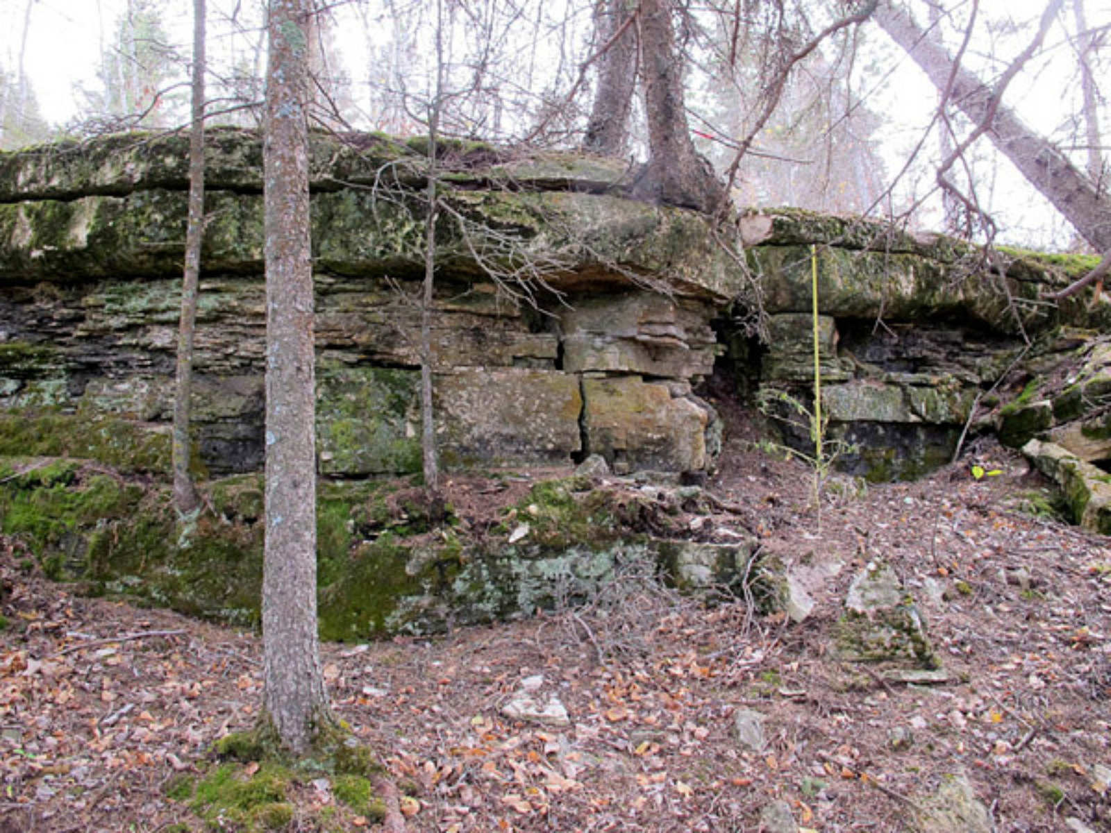
A rugged cut of bank with bare trunks of trees in frame both below and above the cliffside.

Limestone beds in the Fisher Branch area, north of Winnipeg, were deposited during the early part of the Silurian Period, about 440 million years ago.

This slight tilt is, however, very important when we consider where we might find particular layers on the surface. Geologists often talk about the rocks of the Platform as having “layer cake stratigraphy.” Like the onion, the layer cake is a useful metaphor. If we imagine a cake plate being tilted, and then the cake being cut parallel to the tabletop, it is obvious that the lower layers of the cake would be visible from above as you move away from the direction of tilting.

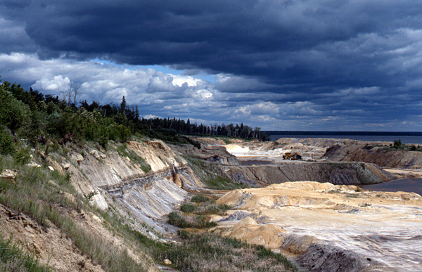
A landscape looking out over the cliffside of a stretch of land leading down to a shoreline. The sky is dramatically lit with thick clouds in shades of light and dark blue.

Similarly, in southern Manitoba we see older layers meeting the ground surface as we move eastward, away from the centre of the sedimentary basin. Although there is Cretaceous bedrock at the surface along the Manitoba Escarpment, the sedimentary rocks in the Winnipeg area are far older. North of Winnipeg we can visit sites that straddle the boundary between the Ordovician and Silurian periods, with Silurian beds about 440 million years old near Fisher Branch, and Ordovician beds 445-450 million years old at Stony Mountain and Stonewall.

The oldest Ordovician sedimentary beds in Manitoba, belonging to the Winnipeg Formation, can be observed toward the eastern side of Lake Winnipeg at places like Manigotagan and Black Island. Just east of these places, however, we reach the bottom of the layer cake. The “cake plate”, if you will, is composed of the very hard, very old rocks of the Precambrian Shield (aka Canadian Shield).


Image: Sandstones of the Ordovician Winnipeg Formation at Black Island, Manitoba, are about 454-458 million years old.

The Shield rocks are geologically complex, having been formed as mountains were growing, volcanoes erupting, and continents crashing together in this region about 1.8-3.5 billion years ago. Since they were formed by such active processes, they are often folded, faulted, and overturned; as a result we can no longer apply our simple onion/cake metaphors once we reach those rocks. But those comparisons work wonderfully in any of Manitoba’s younger strata!


* The growth of onions is apparently quite different from this age-layering of sediment on the Platform, but it is still a handy visual metaphor.

Aschkibokahn mini-diorama

By University of Winnipeg student Kristina Misurska


I would like to introduce Kristina, a Master’s student at the University of Winnipeg, who is completing a program in Curatorial Practices. As part of her internship with the Manitoba Museum (TMM), she is working on a couple of projects to gain experience in different areas of museum studies. Last month, she wrote a blog post about a project with the HBC Collection, and this month she is working with Anthropology Department on exhibit design and programming. This is her first Anthropology blog:

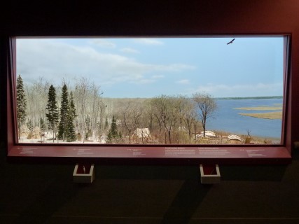
View into a mini diorama showing an area of land progressing through the seasons, and the adaptions of the people living there during each season.

On January 16, TMM unveiled a new display in the Parklands/Mixed Woods Gallery, called the Aschkibokahn mini-diorama. This diorama, the result of nearly twenty years of research, planning, and hard work, explores the activities of an Anishnaabe family from about 800 years ago as they move across the land from winter to summer. The project is based on work undertaken at the Aschkibokahn archaeological site, located near the present-day communities of Duck Bay and Camperville.

One of TMM’s goals for this exhibit is to link the archaeological site to these present-day communities. My role in this project is two-fold. On the one hand, I will be gathering and sorting through existing research to figure out the best ways to integrate this information into a comprehensive exhibit. On the other hand, I will be exploring different means of re-establishing connections with community members in order to gain a fuller picture of the history of the region.


Image: New Parklands Gallery Diorama

I will be posting blogs over the next couple of months to keep everyone up to speed with my project. I hope you all stay tuned to see how the project progresses and I encourage everyone to come down and check out the beautiful new diorama!

Remembering Columbia

The phone woke me up early on a Sunday. My sister calling. She’s not an early riser; something must be wrong.

“I was listening to the news – the space shuttle was supposed to land, but didn’t.” Silence, as I try to process the information.

What?

In 30 seconds I am in the living room, putting on my glasses with one hand and fumbling with the TV remote in the other. I don’t have to switch to NASA-TV. The story is everywhere. The Space Shuttle Columbia, with its crew of seven astronauts, is missing.

Two minutes later, I’m in the car, heading to the Planetarium. We have better resources there, NASA TV direct from satellite and several computers for streaming and searching. I don’t know why I’m going; it’s not like NASA needs me, but I just have to go, to know, to do SOMETHING. I arrive, breathless, to find other co-workers streaming in. Some have tears in their eyes. The reports come slowly: all contact lost during re-entry; no landing; some kind of warning indicators in the left wing; and then the first video of a fireball breaking up in the sky over Texas.

My recollections of the rest of the day are a blur. For the first few minutes, I had held out hope that the crew might have escaped, but that hope quickly dwindles. Columbia is gone.

They were only sixteen minutes from home.

The phones start to ring. Local media, other staff, the public. We watch the news, check forums, watch and re-watch the footage of the launch that we had taped nearly two weeks before. Anderson Cooper, one of CNN’s “new guys” at the time, is at the desk when it happens, and he becomes the face of the tragedy until veteran space reporter Miles O’Brien gets there. All of the talking heads on every network are asking the same question: What had happened?

In the aftermath, it turned out that Columbia was doomed from the time it launched. A piece of insulating foam broke free of the shuttle’s big orange external tank during the launch, damaging the heat shield on the front of the left wing. When the shuttle re-entered the atmosphere, the frictional heating burned through the heat shield, tearing off the wing and causing the shuttle to break apart at 400,000 km/h. NASA had screwed up, and people had died.

Historically, the end of January has been a bad time for space exploration. On January 27, 1967, the first Apollo moon rocket caught fire during routine testing on the launch pad, and three astronauts perished. On January  28, 1986 the shuttle Challenger exploded during launch, killing all seven astronauts aboard. And now a second shuttle and its crew of seven was gone.

In every case, NASA rallied, found, faced and fixed the problems, and moved on. There were words about the cost of exploration, the necessity of risk-taking, the benefits of curiosity and passion. Today, more than a decade after the loss of Columbia, there are people living full-time in space. The International Space Station and the Chinese Tiangong 1 space station orbit overhead, the frontier outposts of our exploration into the universe. But is it worth it? Is it worth seeing crying families every decade or so, immersed in a disaster that grips the world?

There is no right answer, but I can tell you what every member of the crews of Apollo 1, Challenger, and Columbia would tell you: it is not only worth the cost, it is essential. Humanity must explore. The practical reasons are obvious: growing population and dwindling resources on our home planet; knowledge and technology to be gained; searching for other habitable worlds to colonize and explore; the possibility of life elsewhere. But the main reason humanity must explore is this: exploration is one of the defining characteristics of the human species. We have always looked at the horizon and wondered what is out there. It has defined our modern world, and driven the development of technologies that today are essential to our civilization. Exploration built the world we live in, and without it, humanity is doomed to a slow, stagnant decay into extinction.

Today I remember those who have given their lives while exploring space. Thank you for reaching for the stars.

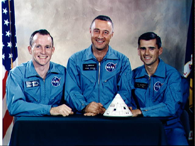
Official photo of the three-man crew of Apollo 1.

Apollo 1 (January 27, 1967)
Virgil  “Gus” Grissom, Command Pilot (United States)
Edward White, Senior Pilot (United States)
Roger Chaffee, Pilot (United States)

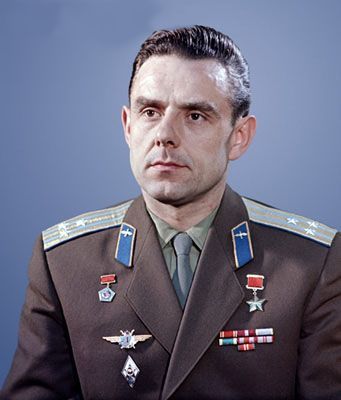
Formal photograph of Vladimir Kamarov in uniform.

Soyuz 1 (April 23, 1967)
Vladimir Kamarov, Commander (Soviet Union)

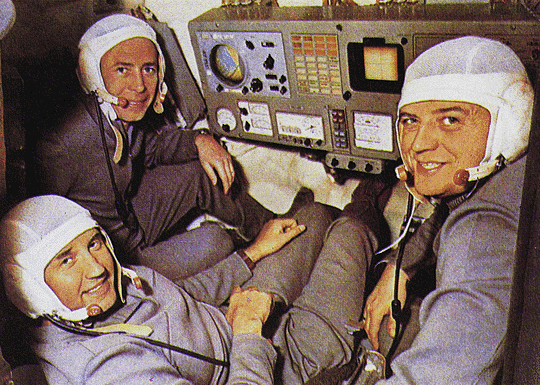
Photo of the three man crew of Soyuz 11 in the cockpit.

Soyuz 11 (June 30, 1971)
Georgi Dobrovolski, Commander (Soviet Union)
Vladislav Volkov, Flight Engineer (Soviet Union)
Viktor Patsayev, Flight Engineer (Soviet Union)

Challenger Mission 51-L (January 28, 1986)
Francis R. Scobee, Commander (United States)
Michael J. Smith, Pilot (United States)
Ronald McNair, Mission Specialist (United States)
Ellison Onizuka, Mission Specialist (United States)
Judith Resnik, Mission Specialist (United States)
Greg Jarvis, Payload Specialist (United States)
Christa McAuliffe, Payload Specialist/Teacher in Space (United States)

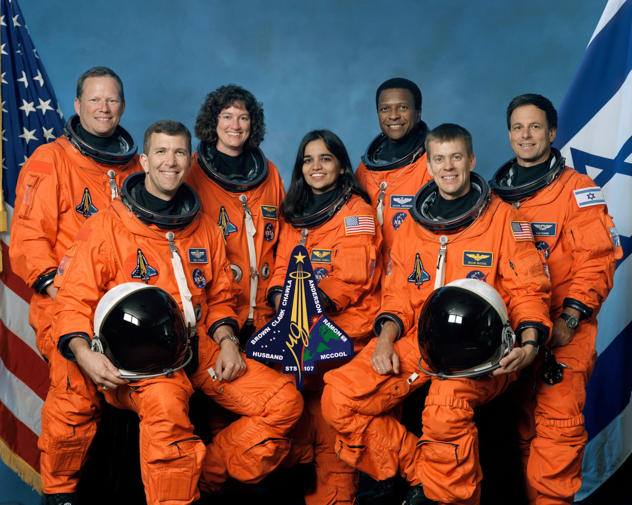
Official photograph of the seven-person crew of Columbia, Mission STS-107.

Columbia, Mission STS-107 (February 1, 2003)
Rick D. Husband, Commander (United States)
William C. McCool, Pilot (United States)
Michael P. Anderson, Mission Specialist (United States)
Kalpana Chawla, Mission Specialist (United States)
David M. Brown, Mission Specialist (United States)
Laurel Clark, Mission Specialist (United States)
Ilan Ramon, Mission Specialist (Israel)

Scott Young

Scott Young

Planetarium Astronomer

Scott is the Planetarium Astronomer at the Manitoba Museum, developing astronomy and science programs. He has been an informal science educator for thirty years, working in the planetarium and science centre field both at The Manitoba Museum and also at the Alice G. Wallace Planetarium in Fitchburg, Massachusetts. Scott is an active amateur astronomer and a past-President of the Royal Astronomical Society of Canada.