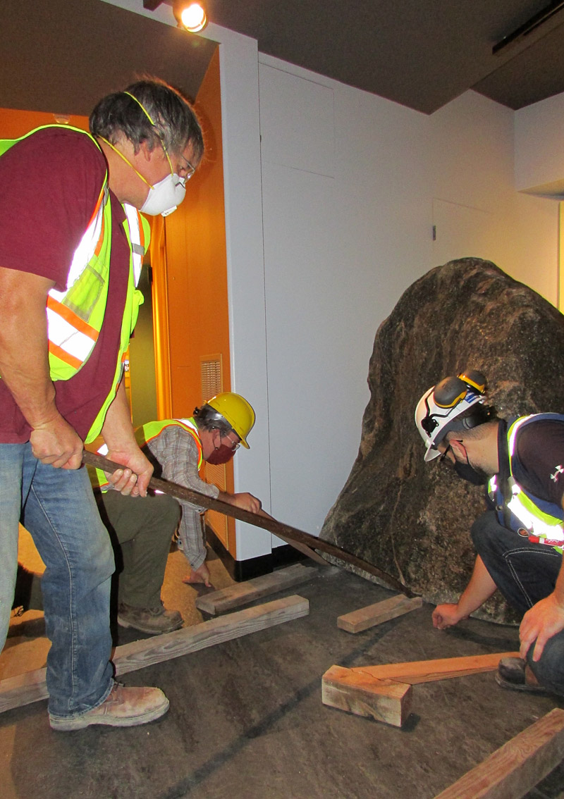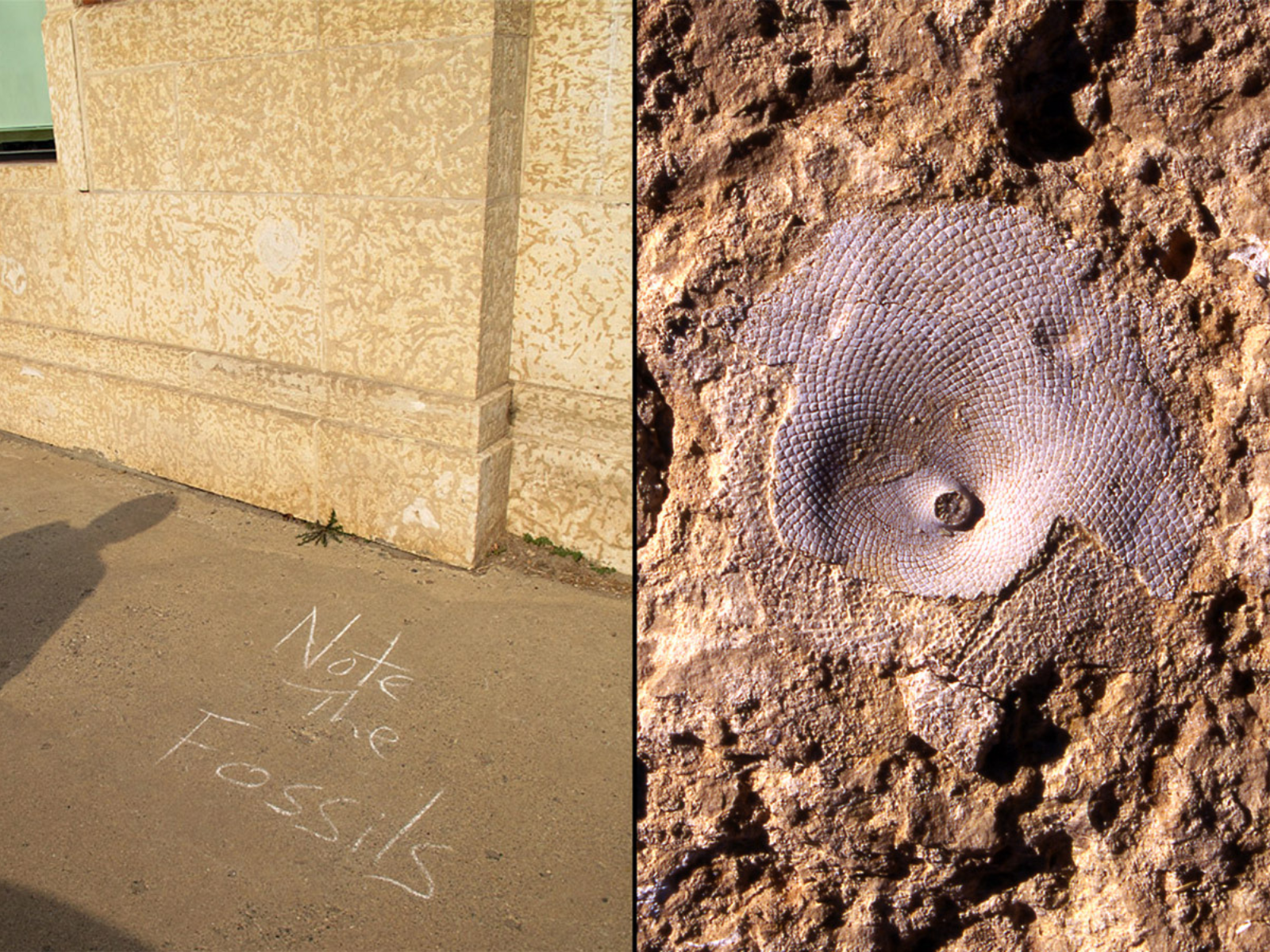
Posted on: Tuesday April 14, 2026
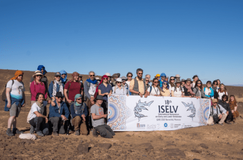
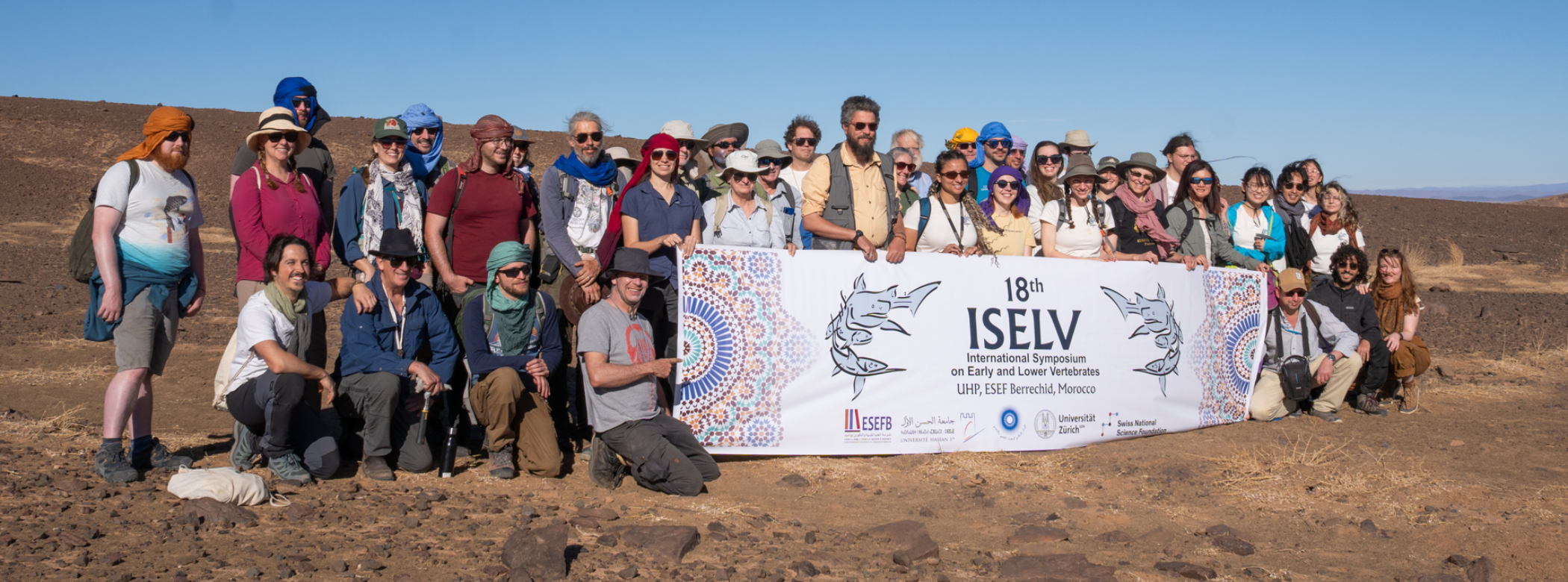
Conferences are an invaluable opportunity to share the Museum’s work with the global scientific community, and they also offer a chance to make connections with the natural and human history of other parts of the world. Recently, I had the opportunity to take part in the International Symposium on Early and Lower Vertebrates, hosted in Berrechid, Morocco. This conference brought together researchers from around the world studying fossils of early fish and four-limbed vertebrates, as well those studying their modern relatives to learn about ancestral characteristics. This was a perfect opportunity to share new collaborative work on early armoured fish from Manitoba. In addition, I had the chance to join a post-conference field trip to learn about the geology and palaeontology of Morocco.
Image: Conference logo for ISELV 2026. The design was inspired by characteristic Moroccan fossils, Arabic calligraphy, and the zellige style of geometric mosaic tilework which is culturally significant to the region.
On its surface, Morocco’s landscape couldn’t be more distinct from that of Manitoba: towering snow-capped mountains, vast desert regions of exposed rock, and precious few lakes. And yet, when one peers deeper, these two regions have profound linkages in terms of their geological history. Both Manitoba and Morocco were once located close to the equator and largely submerged beneath vast seas during the early to middle Paleozoic Era, roughly 540 to 300 million years ago. The inundation of these distant continents was notably due to higher sea levels, thanks to less polar ice and tectonic processes occurring at that time. Owing to their similar past environments, there are also many connections in the fossils which can be found in these regions.
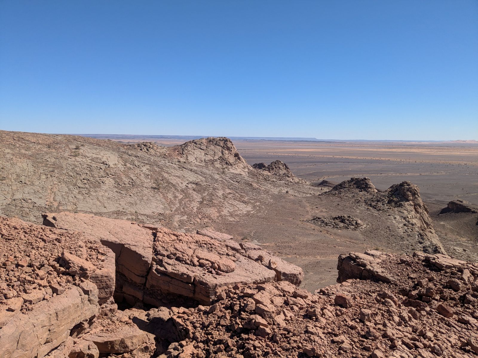
The destination for our field trip was a broad region of the Anti-Atlas Mountains along the edge of the Sahara Desert. Reaching them meant crossing over the High Atlas Mountains, a journey which took the better part of a day. Along the way, we passed villages nestled into the high peaks, majestic kasbahs (the Moroccan equivalent of castles), and roadside tourist stands showcasing a bewildering array of clothing, souvenirs, minerals, and fossils (many of them forgeries or highly altered). The rain shadow produced by the Atlas Mountains is straight out of a textbook; it was close to zero degrees, overcast, and snowing as we traversed the mountain pass, but transitioned to bright sun and up to 30 degrees as we descended into the desert beyond. Upon glimpsing the desert landscape, it’s no mystery why Morocco has been a filming site for many iconic movies and shows. As we broke for the night, we snacked on dates, biscuits, and tea served on polished stone tabletops sporting gorgeous fossil cephalopods.
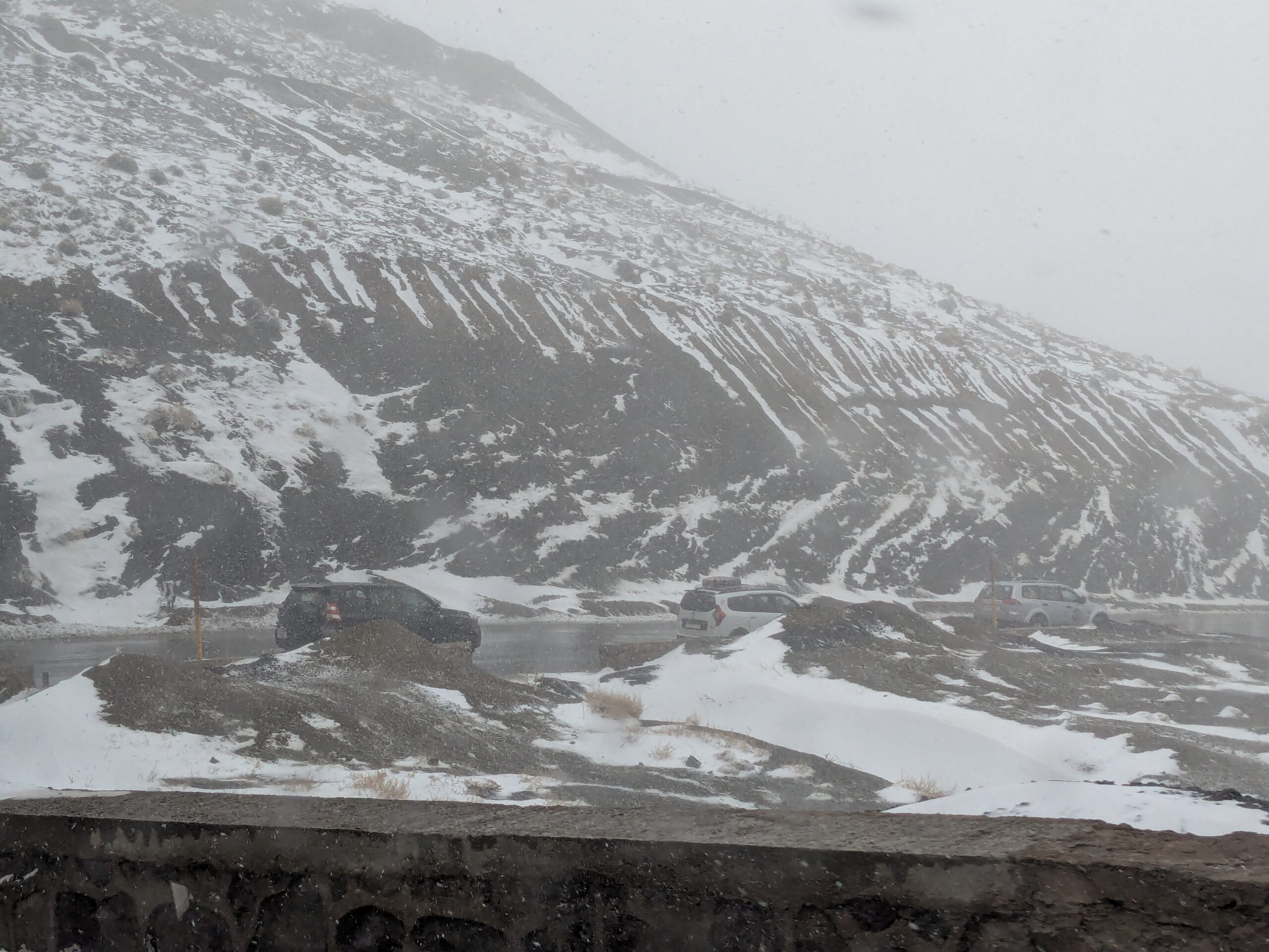
While crossing through the High Atlas Mountains, we encountered a snow storm.
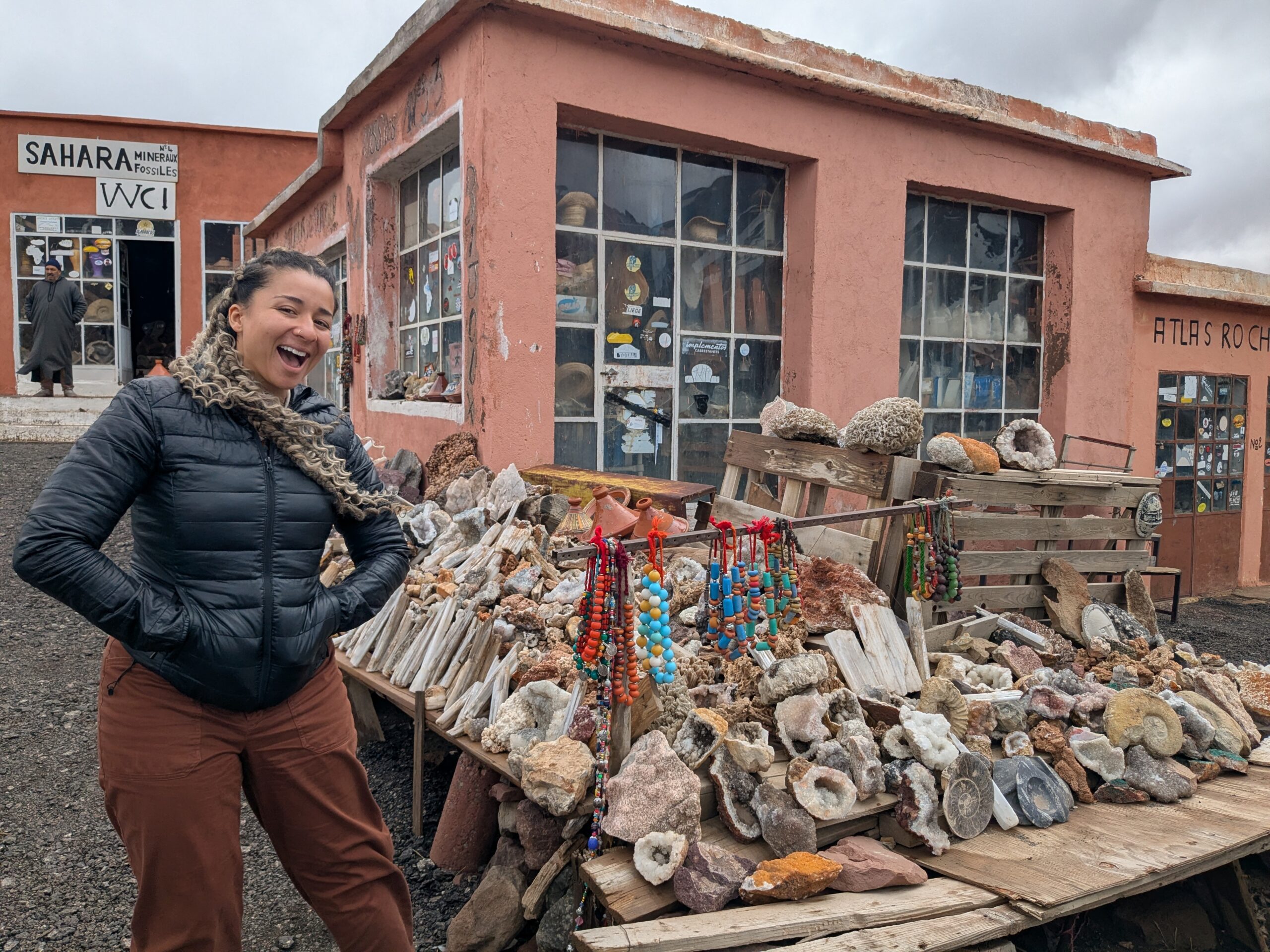
Checking out the shops at a roadside stop.
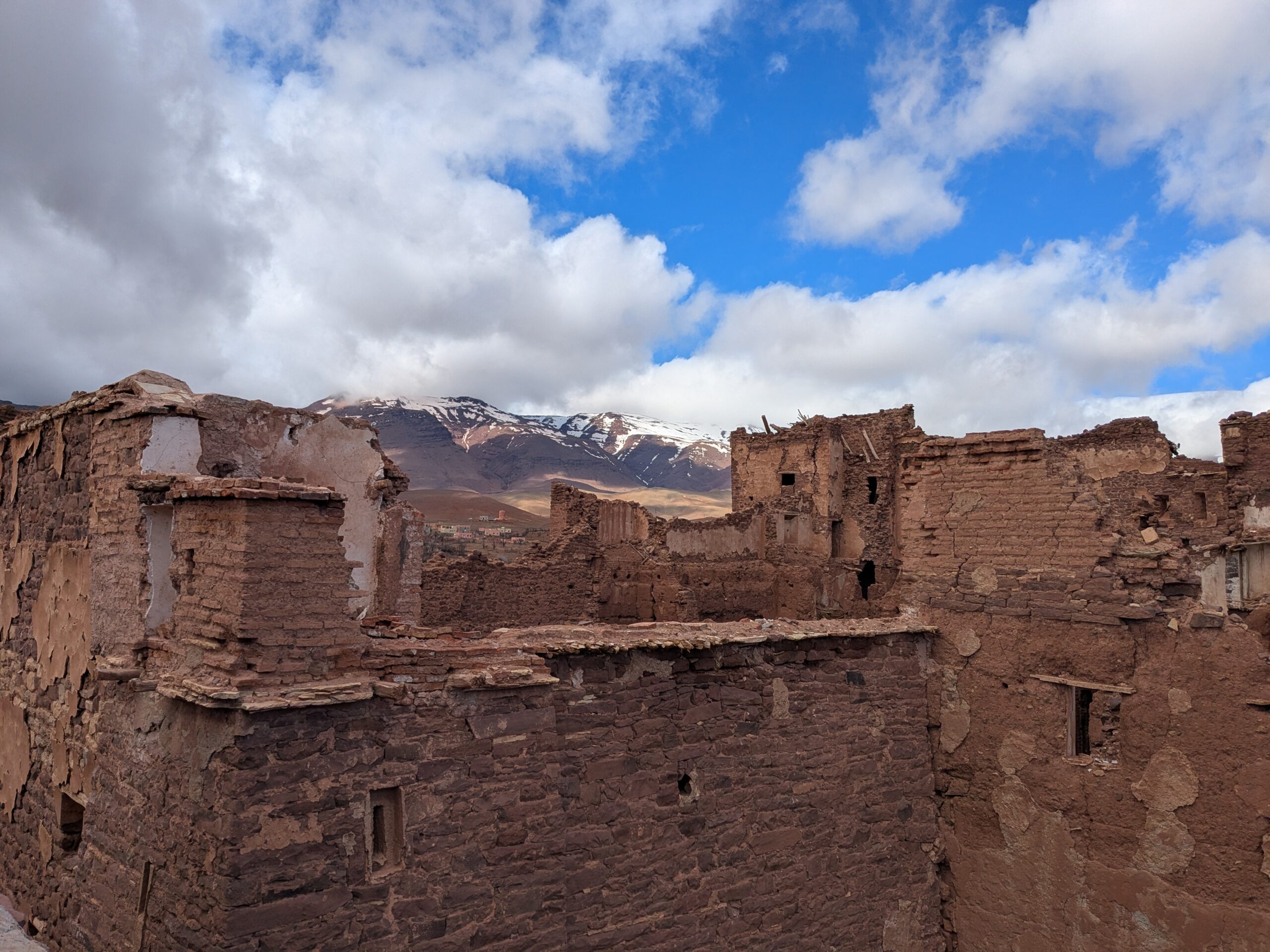
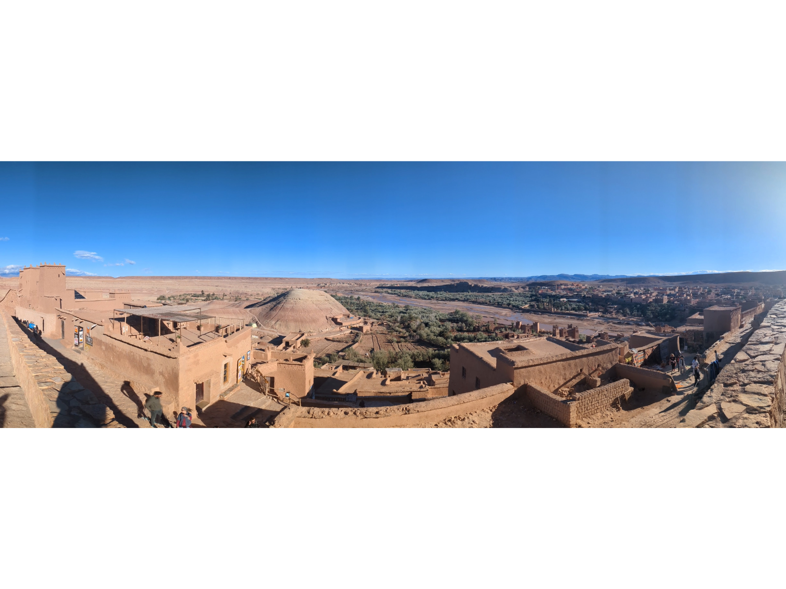
View from the top of the ruins of Telouet Kasbah.
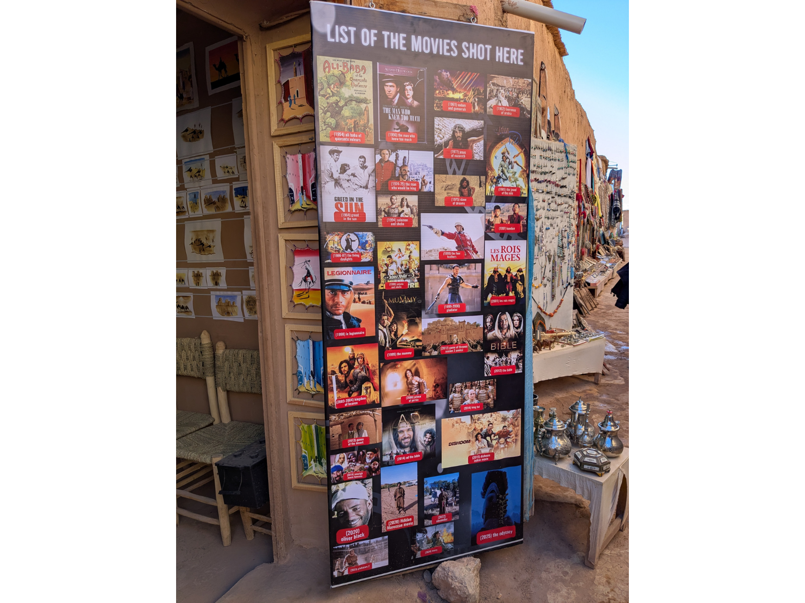
A list of movies and shows filmed at Aït Benhaddou.
Aït Benhaddou, a popular location for movie shoots.
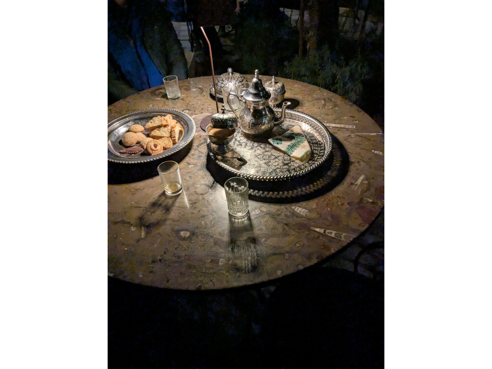
Table at our hotel made of fossil-rich limestone.
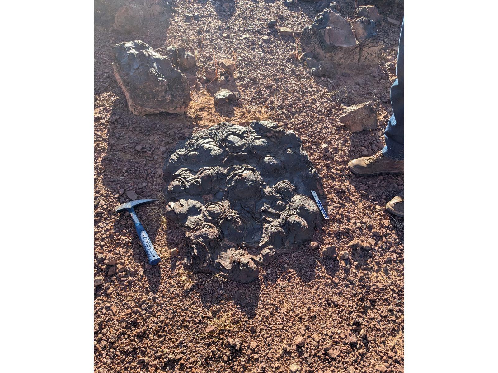
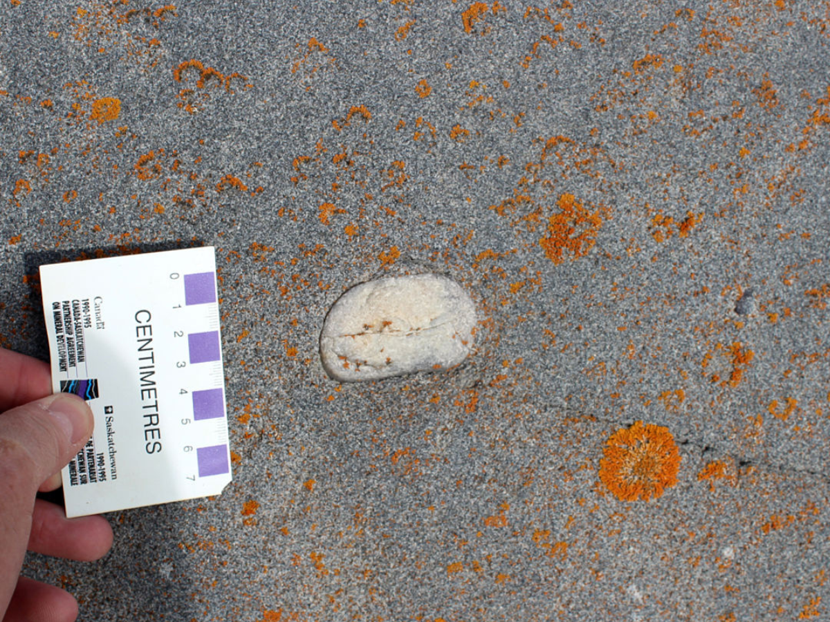
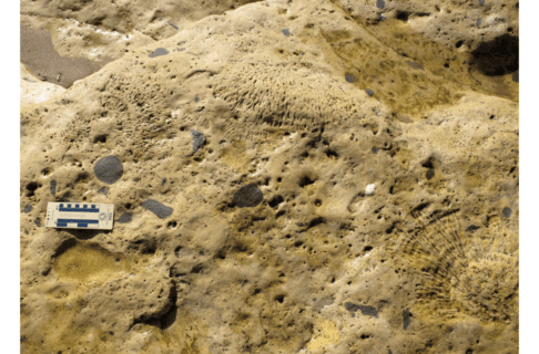
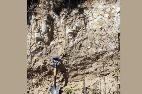
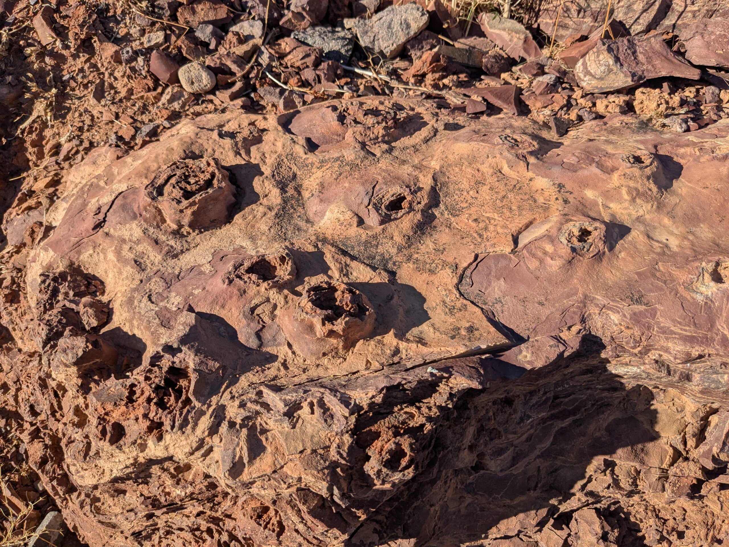
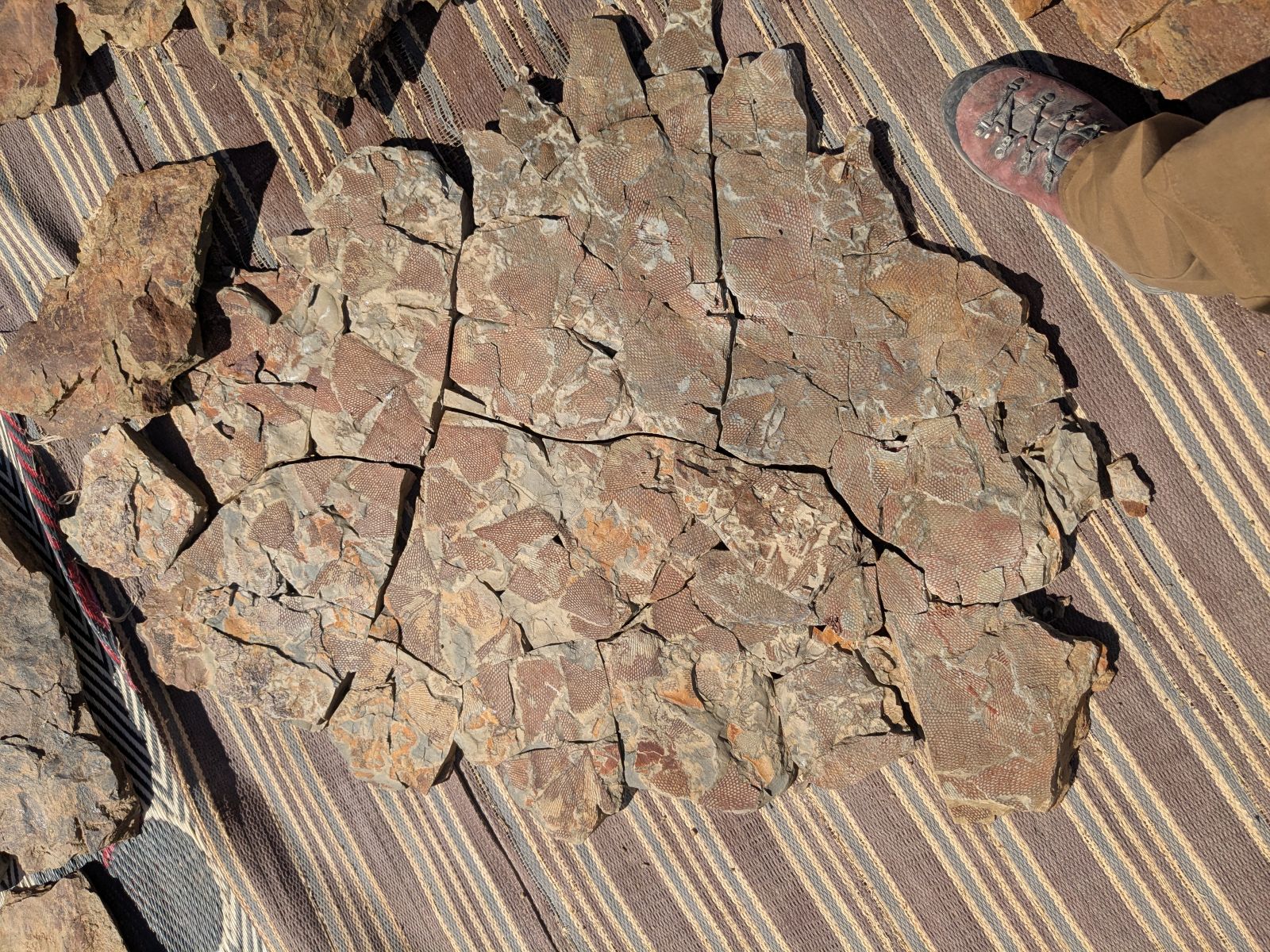
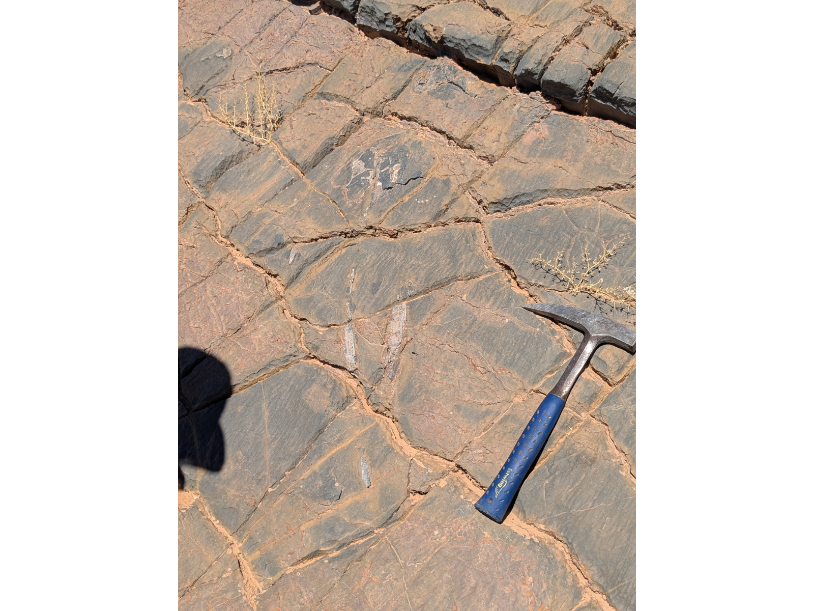
After an all-too-brief night sleep, we awoke to views of the high mountains which we’d just traversed and a delicious breakfast of baghrir and msemen (similar to pancakes) before getting back on the road. Our first palaeontological stop was a road cut near Agdz showcasing stromatolites from the early Cambrian Period, around 540 million years ago. Stromatolites are layered rocks produced by the growth of blue-green algae (cyanobacteria). The cyanobacteria form a sticky mat to which sediment adheres. As sediment builds up, the bacterial mat grows up through it, forming layer upon layer, and often developing into a series of mounds. Cyanobacteria might seem unassuming, but they are the architects of what is perhaps the most remarkable biological transformation ever seen on Earth, known at the Great Oxygenation Event. They are the first known organisms capable of photosynthesis, that is the production of sugars from sunlight and carbon dioxide, producing oxygen (O2) as a waste product.
Image: Large patch of stromatolites, with an eroded upper surface showing onion-like layering.
Over time, oxygen built up in the atmosphere and oceans, leading to wide ranging effects such as the generation of the ozone layer that protects us from UV radiation, the oxidation of iron, producing most of the iron ore that we rely on today, the formation of thousands of new kinds of minerals which contain oxygen, and ultimately the evolution of more complex living cell types and the earliest multicellular organisms, which rely on oxygen for their metabolism. Ironically, the evolution of the first herbivorous animals seems to have led to a rapid decline in stromatolites around the beginning of the Cambrian Period. While less abundant, stromatolites still survive to this day in environments that are inhospitable for their herbivores, such as the famous Shark Bay site in Australia. Fossils of some of these post-Cambrian survivors also occur widely in Manitoba.
Mound-shaped stromatolites projecting from a horizontal rock bed.
Vertical cross section through some stromatolites, showing their layered structure.
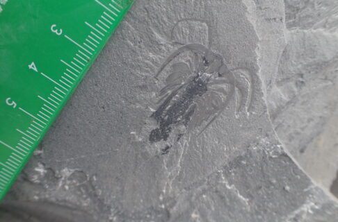
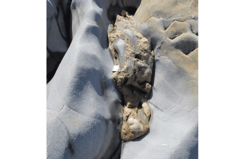
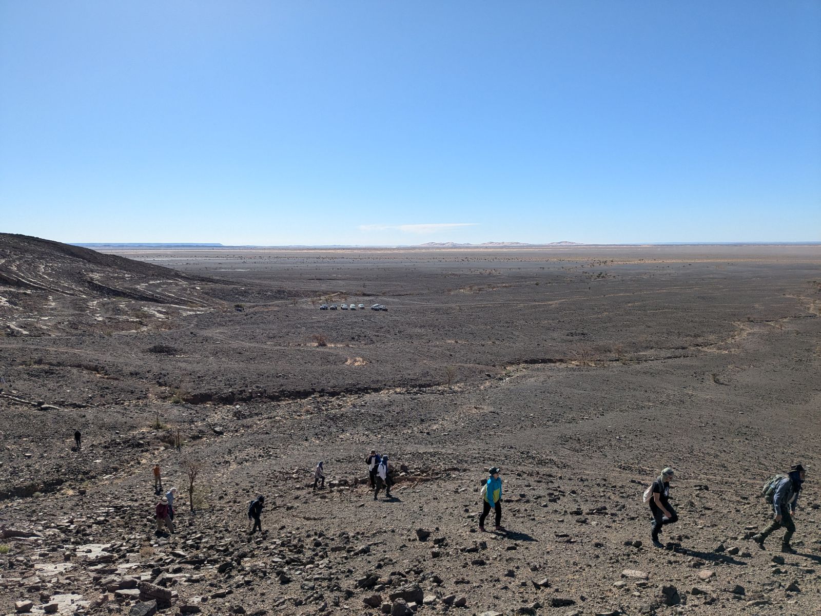
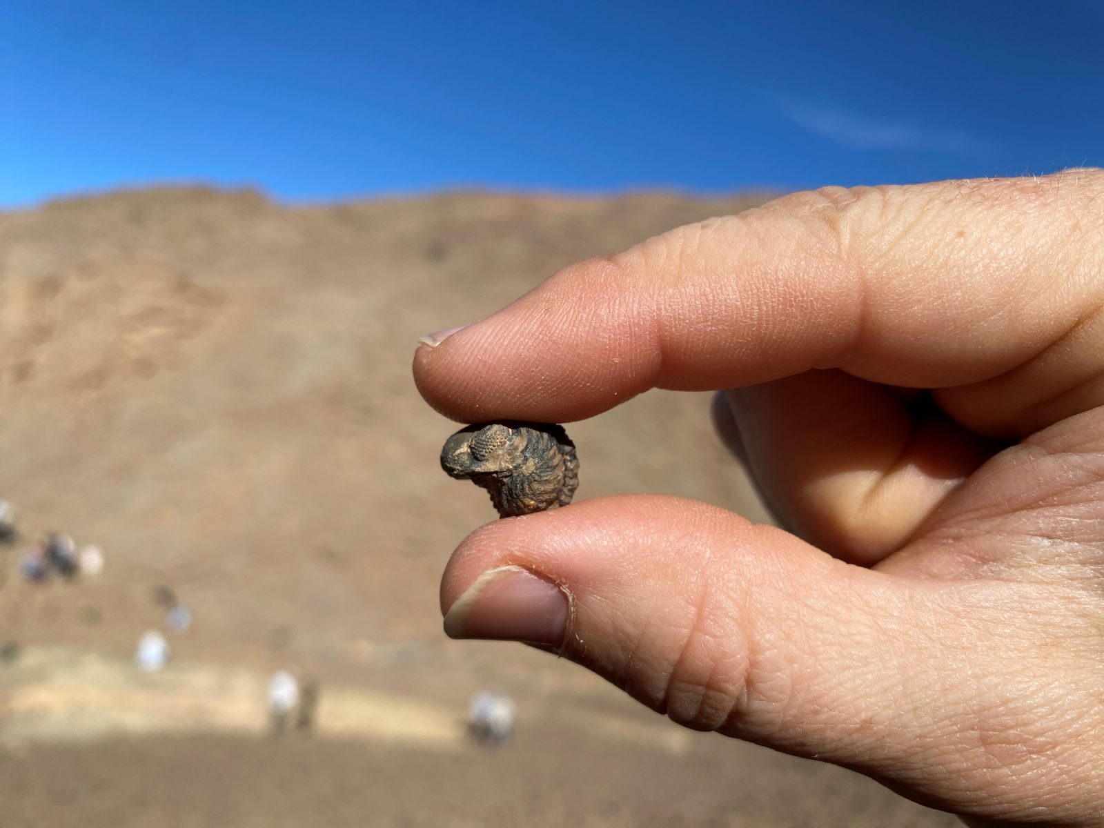
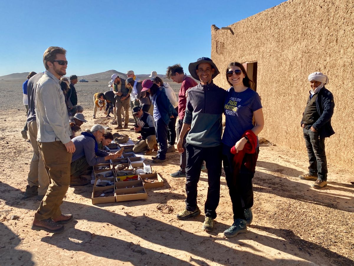
After driving for a few hours, we had an opportunity to visit the Fezouata Shale, which dates to the early Ordovician Period, around 477 million years ago. This site is world renowned for its fossilization of soft tissues and has been compared to other famous localities like the Burgess Shale. It also shares this type of preservation with three slightly younger sites in Manitoba: Cat Head, William Lake, and Airport Cove. This exceptionally preserved fossil deposit was first explored and recognized by Moroccan fossil collector Mohamed Oussaid Ben Moula. Ben Moula’s contributions to science have since been widely acknowledged, including through the naming of a species after him. We had the opportunity to visit Ben Moula’s family home and view some of his most recent collections, laid out in his yard! The fossils included beautiful trilobites preserving their antennae, giant marine filter feeders called radiodonts, armoured bristle worms, branching colonies of graptolites, and bizarre extinct echinoderms called stylophorans, to name just a few. Some of the fossils even represented new species (at least one that I spotted was acquired for a local museum collection). It will be exciting to see if any of the species found at Fezouata can also be found at sites in Manitoba. After the collection visit, we drove off the highway into the desert to one of the dig sites and were able to spend a short time searching for fossils. The group found some very nice trilobites and echinoderms, though none of the rarer species made an appearance.
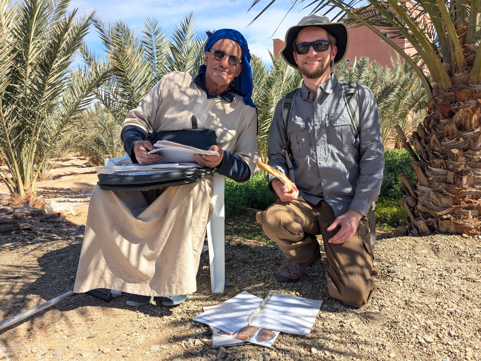
Mohamed Oussaid Ben Moula and I. He was pleased to share some of the publications which he has contributed to.
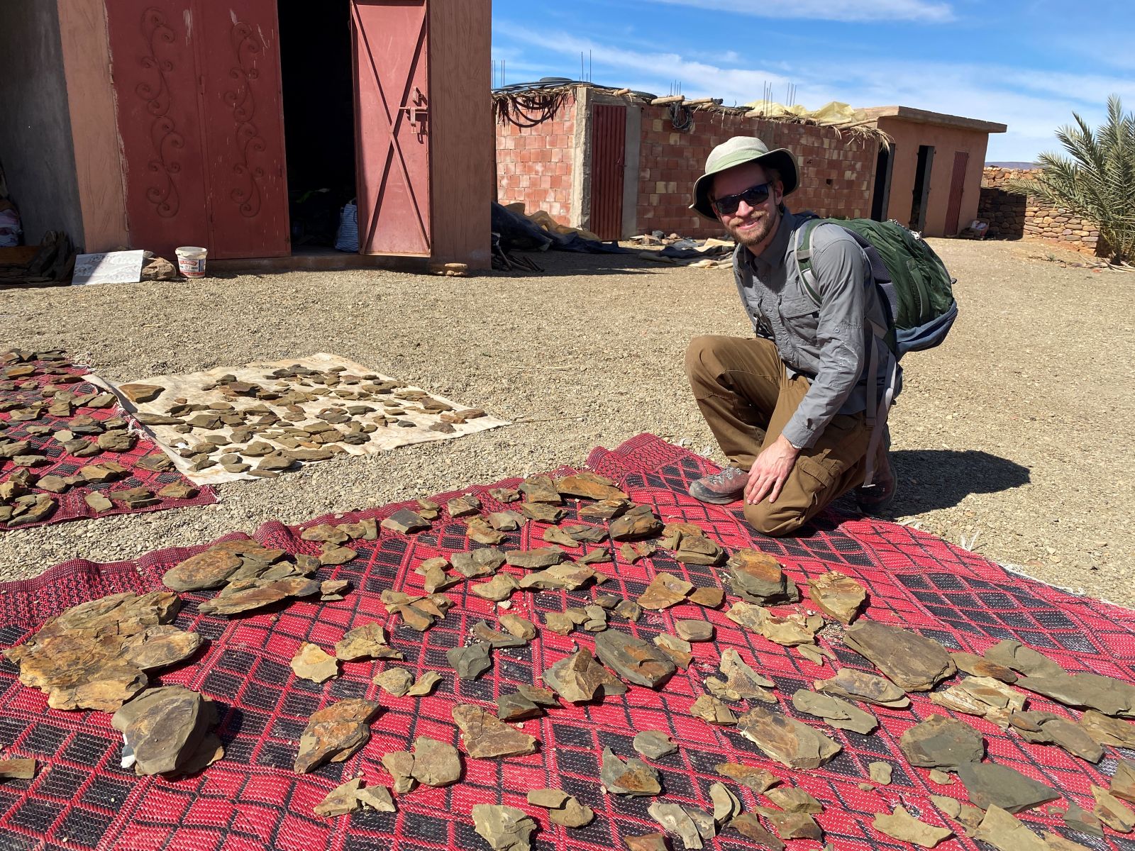
Checking out Ben Moula’s spectacular collection of fossils from the Fezouata deposit. Image courtesy of Jorge Mondéjar Fernández.
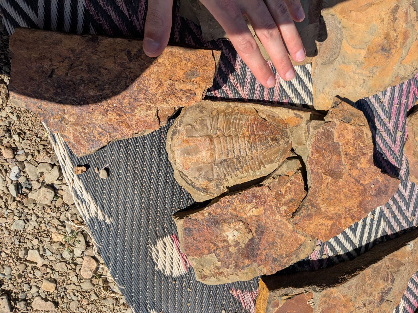
Large asaphid trilobite.
Rake-like claw of Aegirocassis benmoulai, a giant filter feeding radiodont.
Huge slab covered in the graptolite Araneograptus murrayi.
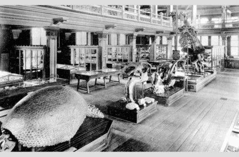
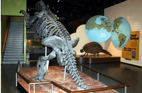
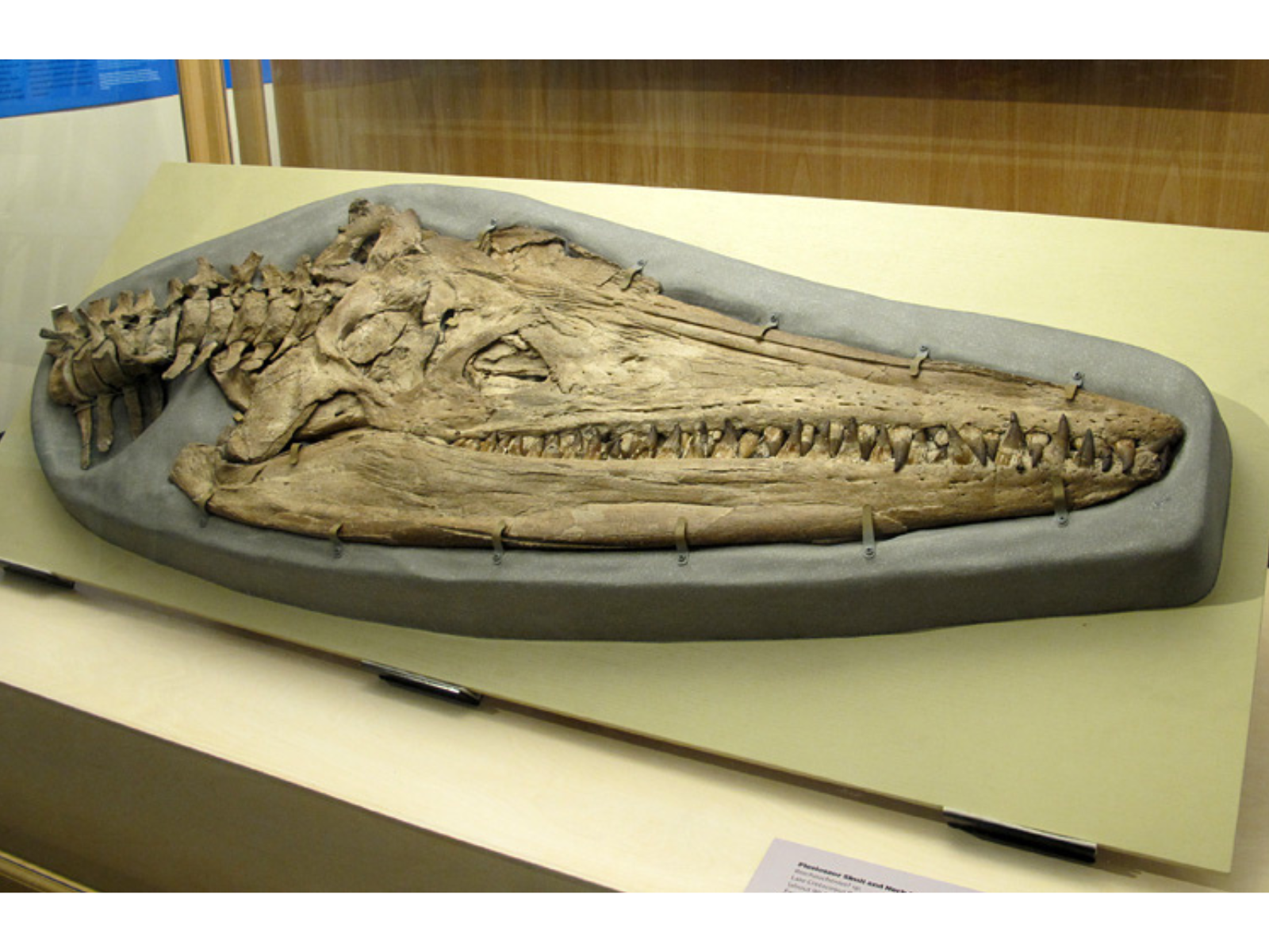
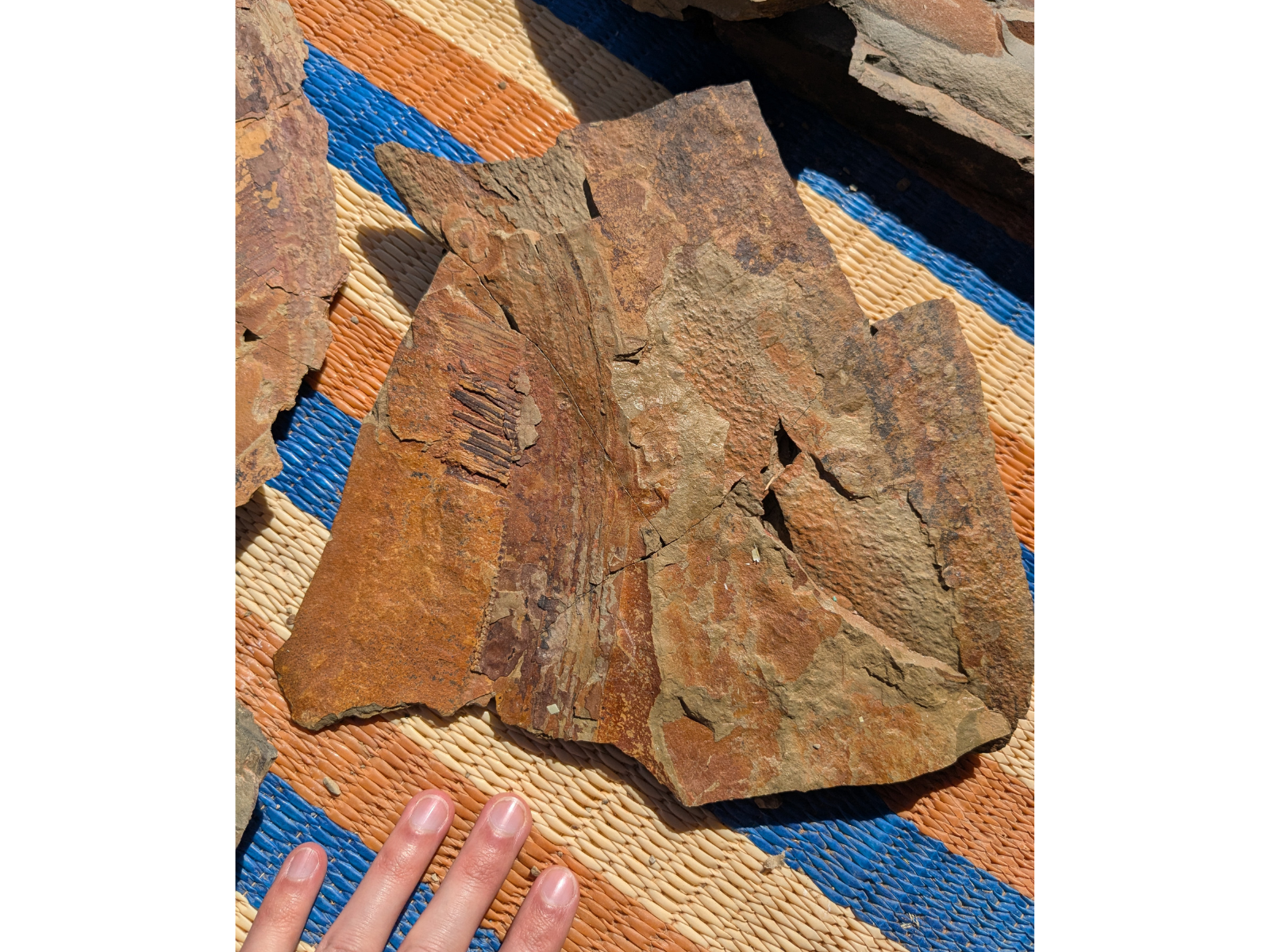
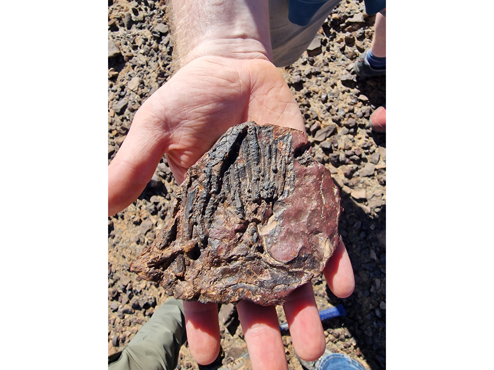
After spending the night near Erfoud, we ventured forward in time to the Devonian Period, viewing a variety of sites ranging from about 400 to 360 million years old. The Devonian has been referred to as the “age of fishes,” and given the topic of our conference, our main goal was to survey the occurrence of these animals in the region. Two groups of fishes are particularly abundant in the region: early sharks and placoderms. The latter are thought to have been the first vertebrates to evolve jaws and teeth and include giant species like Dunkleosteus terrelli (a replica of which is on display in our Earth History Gallery) as well as more modest-sized Elmosteus lundarensis from Manitoba.
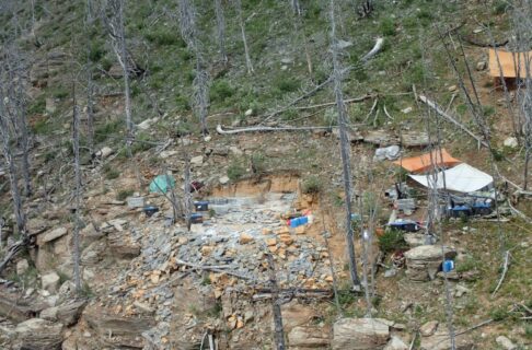
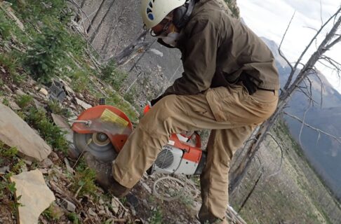
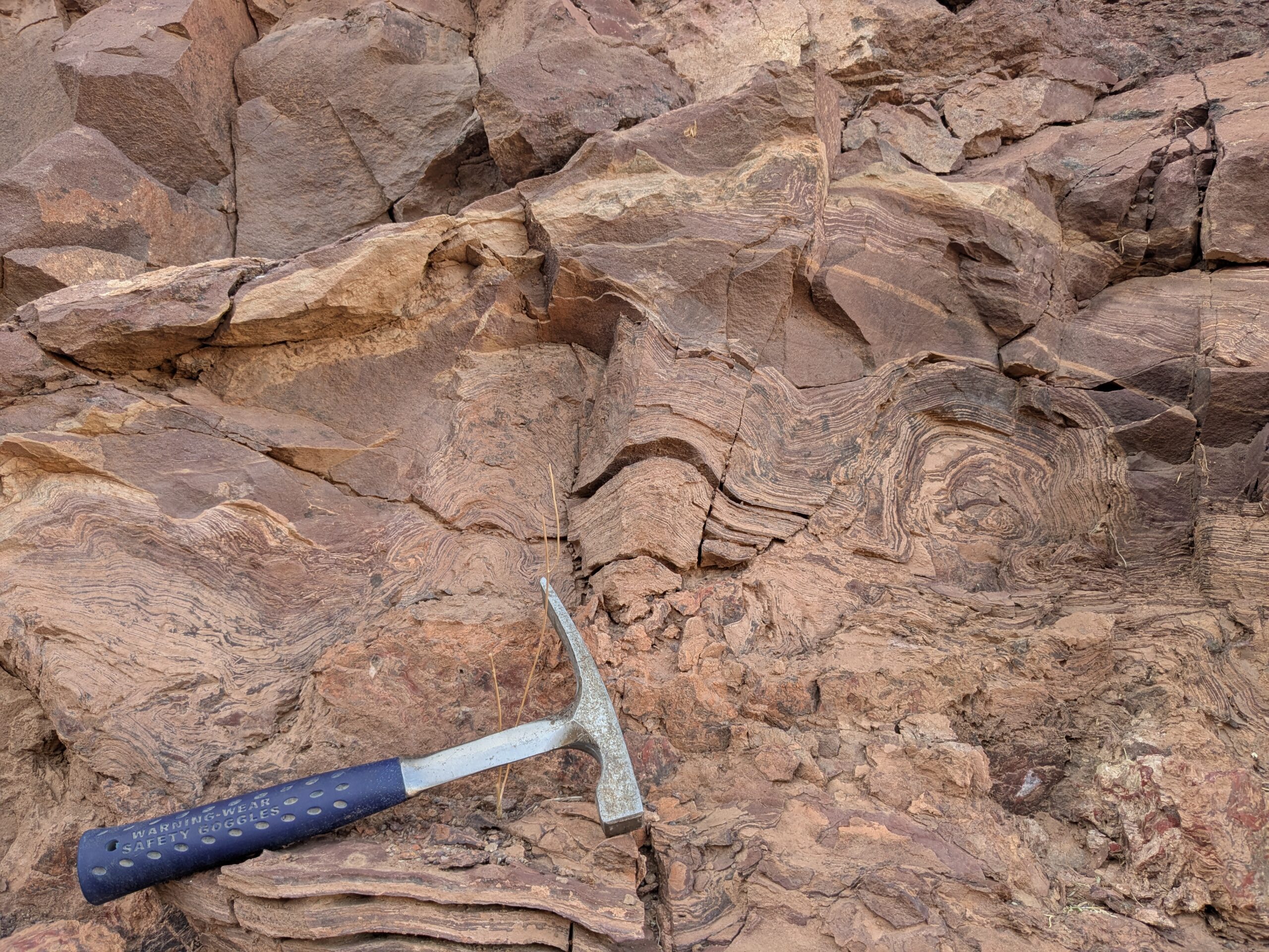
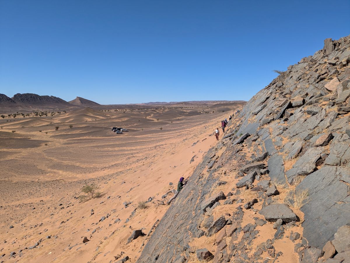
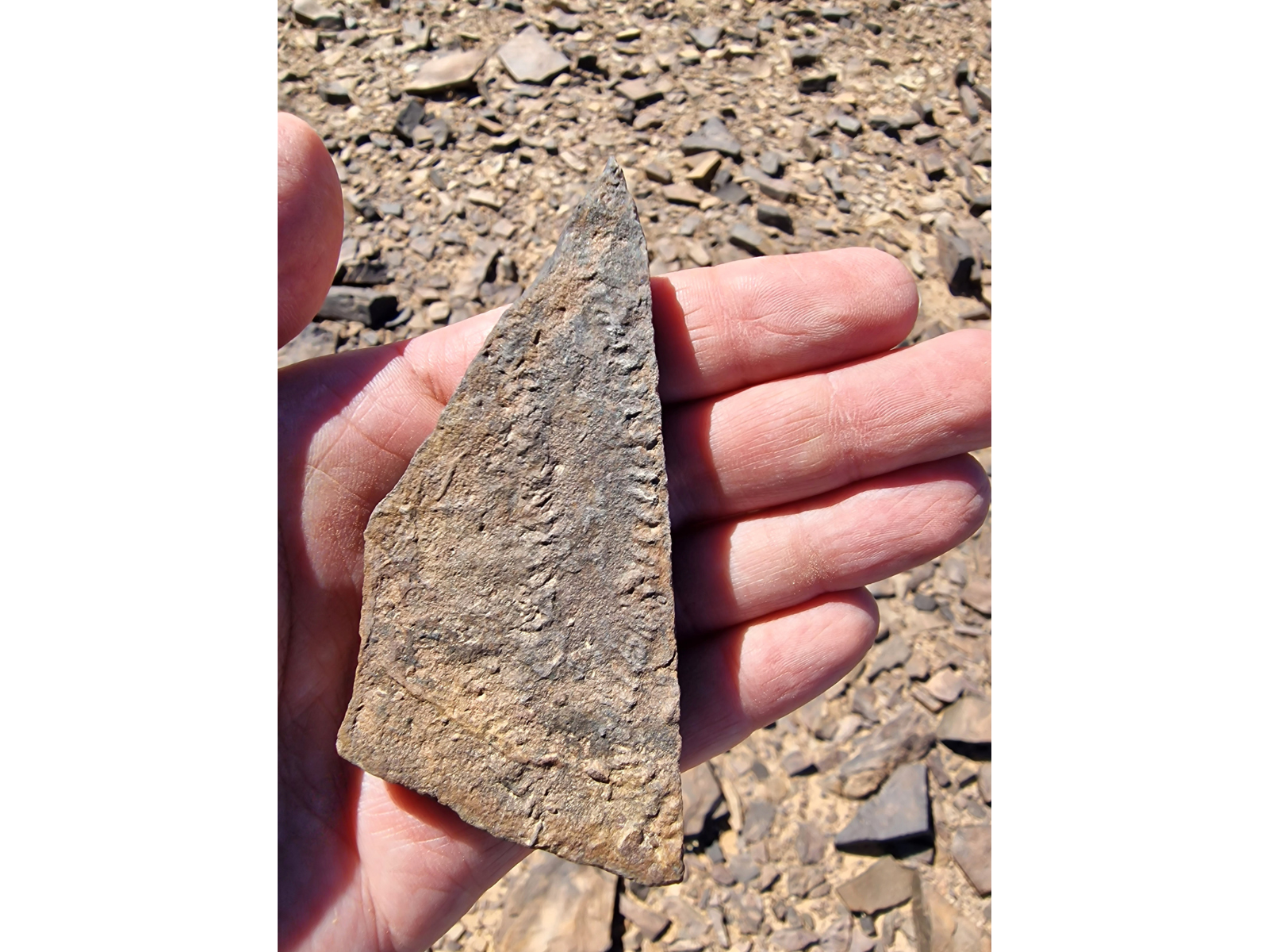
Our first Devonian site, Hamar Laghdad, preserves spectacular mud mounds – gigantic reef-like structures – teeming with fossilized life. As we ascended the peak from where our cars parked, we stepped over thousands of fossilized corals, brachiopods, cephalopods, and trilobite parts. In certain places, ancient crevices within the mud mounds were occupied by huge numbers of trilobites, possibly as safe havens for moulting their hard exoskeletons. Elsewhere, a quirk of fossil preservation caused by the movement of iron rich fluids through the rock has tinted the trilobites red and their eyes faintly green. Huge pits and caverns excavated by commercial collectors pointed the way to the richest fossil beds, and many fragments could be seen in the discard piles nearby. Slightly further along, in the youngest part of the outcrop section, we finally found fish remains. While stopping to chat with a colleague, I noticed a cylindrical chunk of fossil bone lying next to my boot. This turned out to be a section of the lower jaw of a placoderm fish called Alienacanthus malkowskii. This remarkable species had one of the most extreme “underbites” known from any animal! Shortly after, another member of our group found a large piece of bone belonging to Titanichthys termieri, a giant filter feeding placoderm. As we prepared to depart the site, we noticed several rock fragments on the desert floor near the cars which resembled stone tools, hinting at the long history of human occupation of this region.
Climbing up from the dessert floor at Hamar Laghdad, Erg Chebbi in the background.
View from the top of Hamar Laghdad. The low peaks are the remains of more erosion-resistant mud mounds.
A pair of breviconic (“stubby-shelled”) cephalopods.
An enrolled phacopid trilobite found by a colleague. Image courtesy of Jorge Mondéjar Fernández.
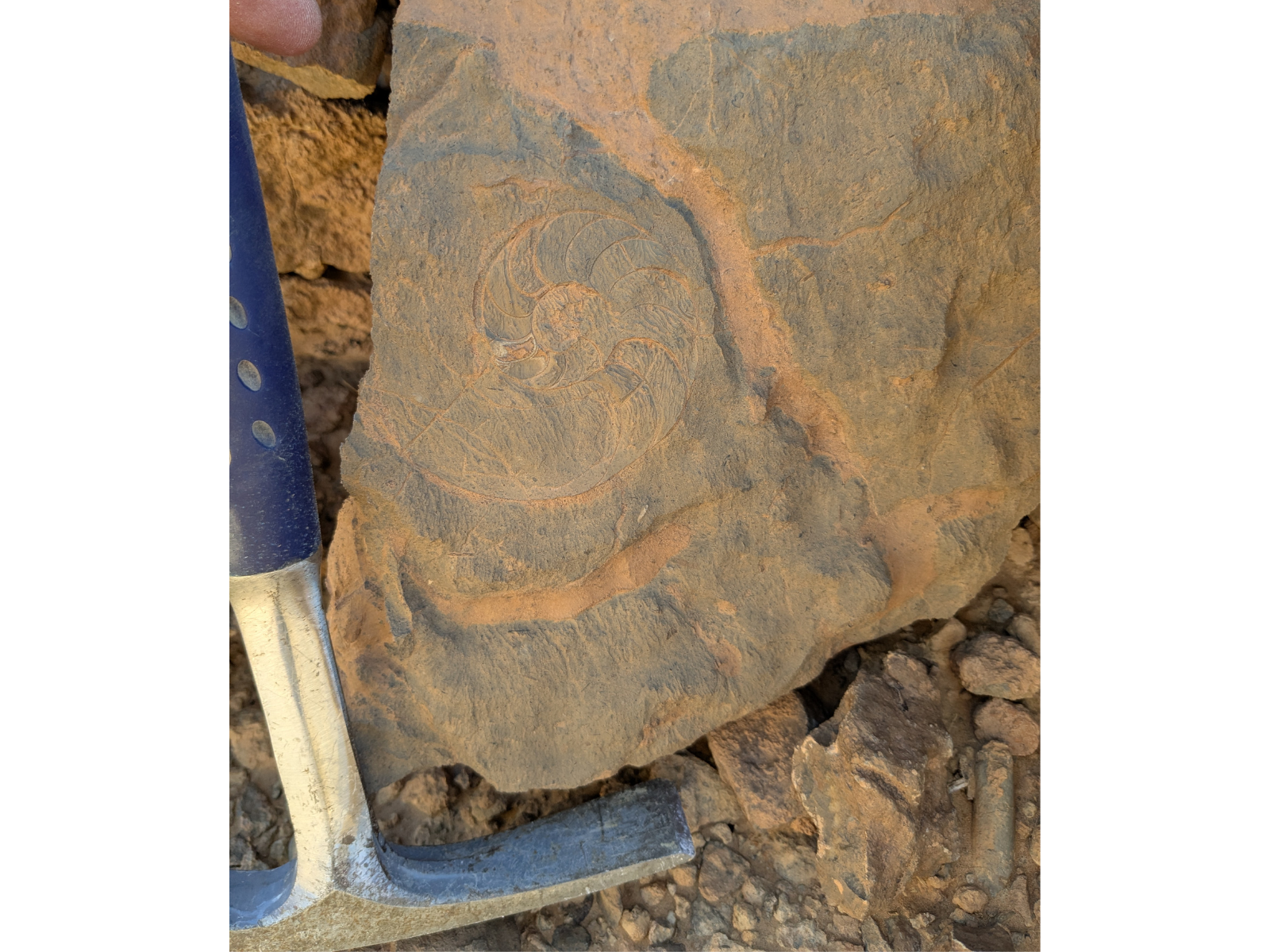
A goniatite, a type of early ammonoid cephalopod. Note the scouring of the surface by wind-blown sand.
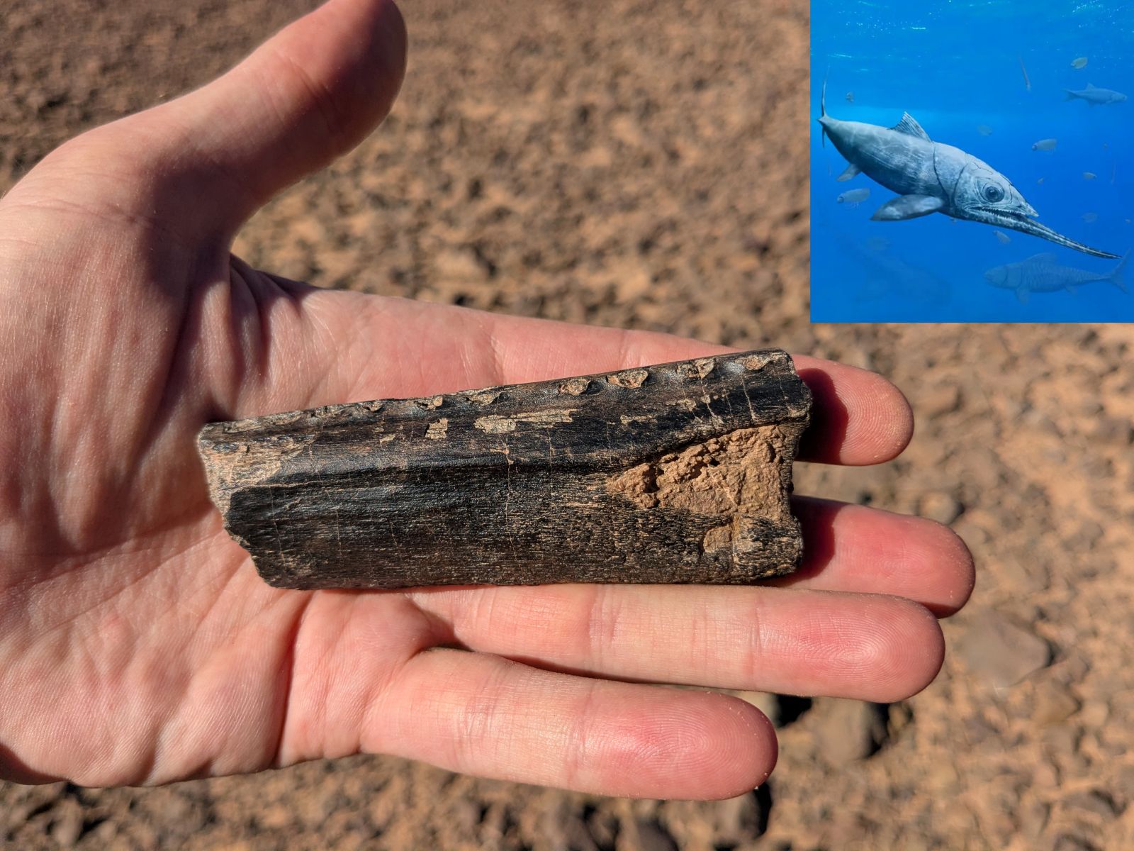
Section of the lower jaw of Alienacanthus. The pits along the top surface are the eroded bases of the teeth. Artistic reconstruction by Beat Scheffold and Christian Klug.
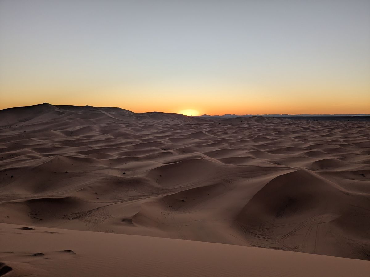
We finished the day with a brief sunset visit to the incredible sand dunes of Erg Chebbi (“Erg” is derived from the Arabic word for dune field). Some of the dunes tower over a hundred metres high and the field spans for many kilometres. This dune field bears some resemblance to landforms closer to home, like Manitoba’s Spirit Sands, though it has a somewhat different origin. Erg Chebbi has been built up by prevailing winds, gathering sand from across a vast expanse of desert and leaving the surrounding areas a flat, barren rocky plain. Amazingly, though, oases dot the edge of the erg due to a very shallow water table in this area, caused by impermeable rock below and an ingenious network of tunnels engineered to channel water towards communities. Adjacent to the erg, the community of Merzouga is a major tourist attraction, featuring opportunities for camel rides and dune buggy adventures. We also saw several motorbikes and racing cars, as the area is used as a training ground for the Dakar Rally.
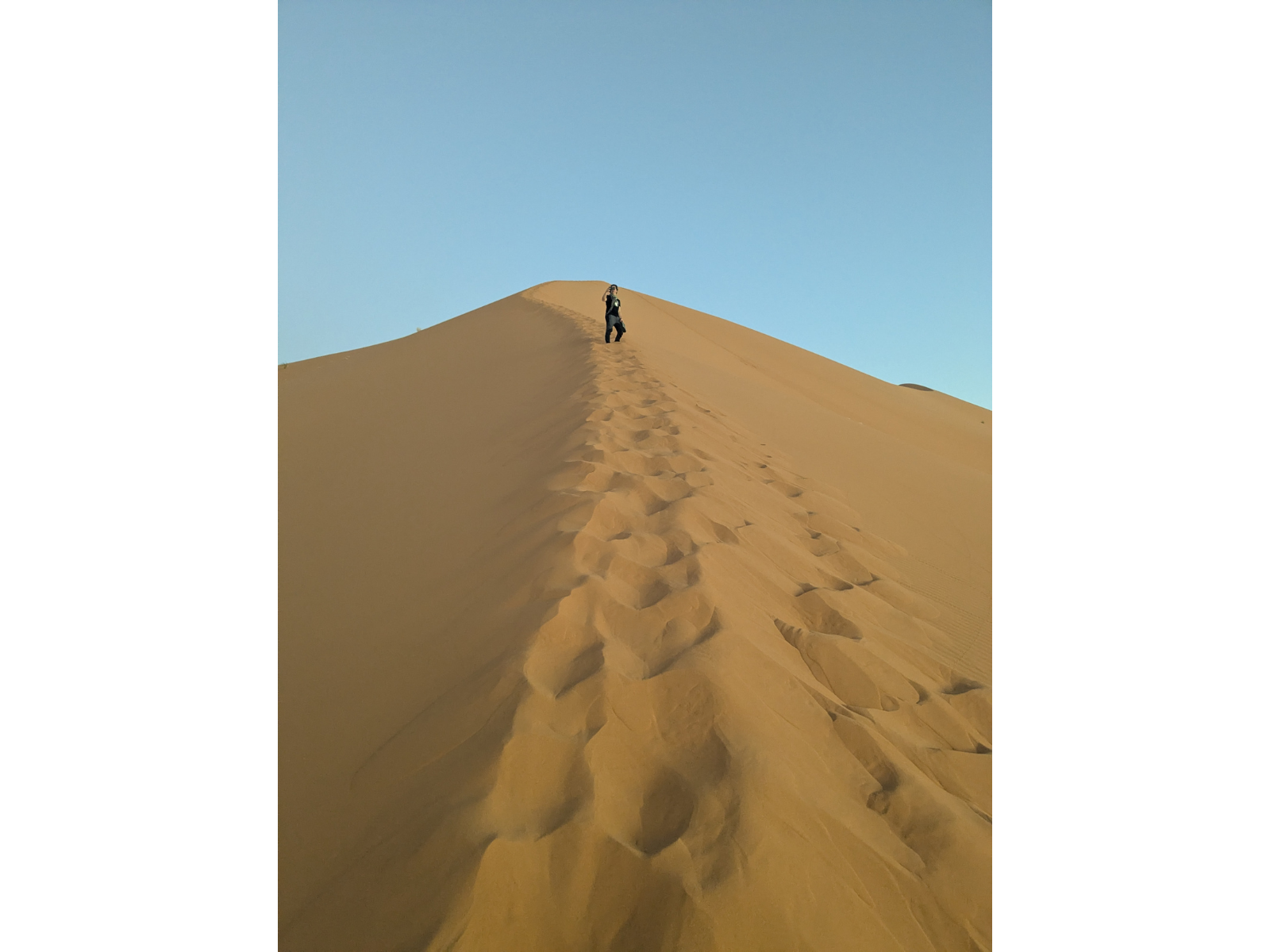
Image: Scaling to the top of a giant dune was quite a workout!
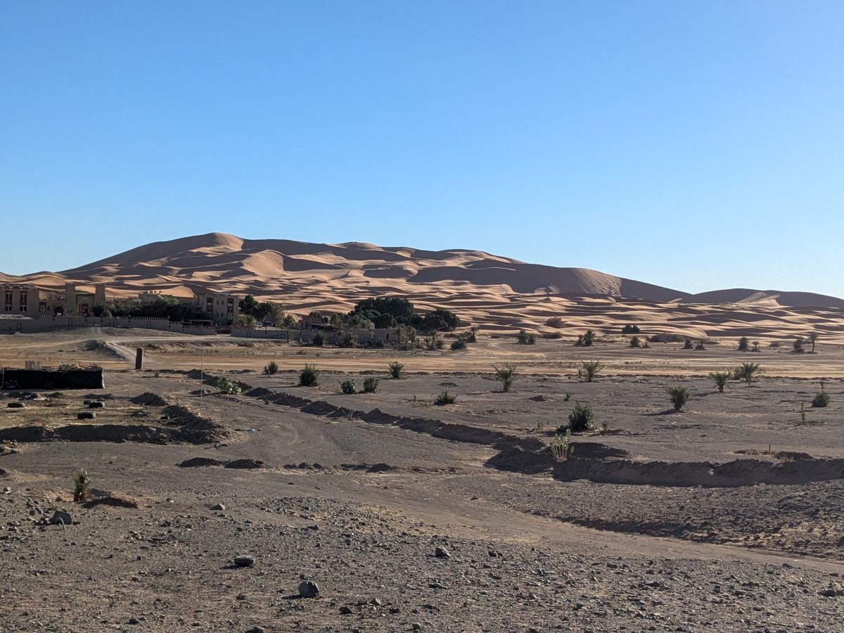
Dunes towering over a resort complex.
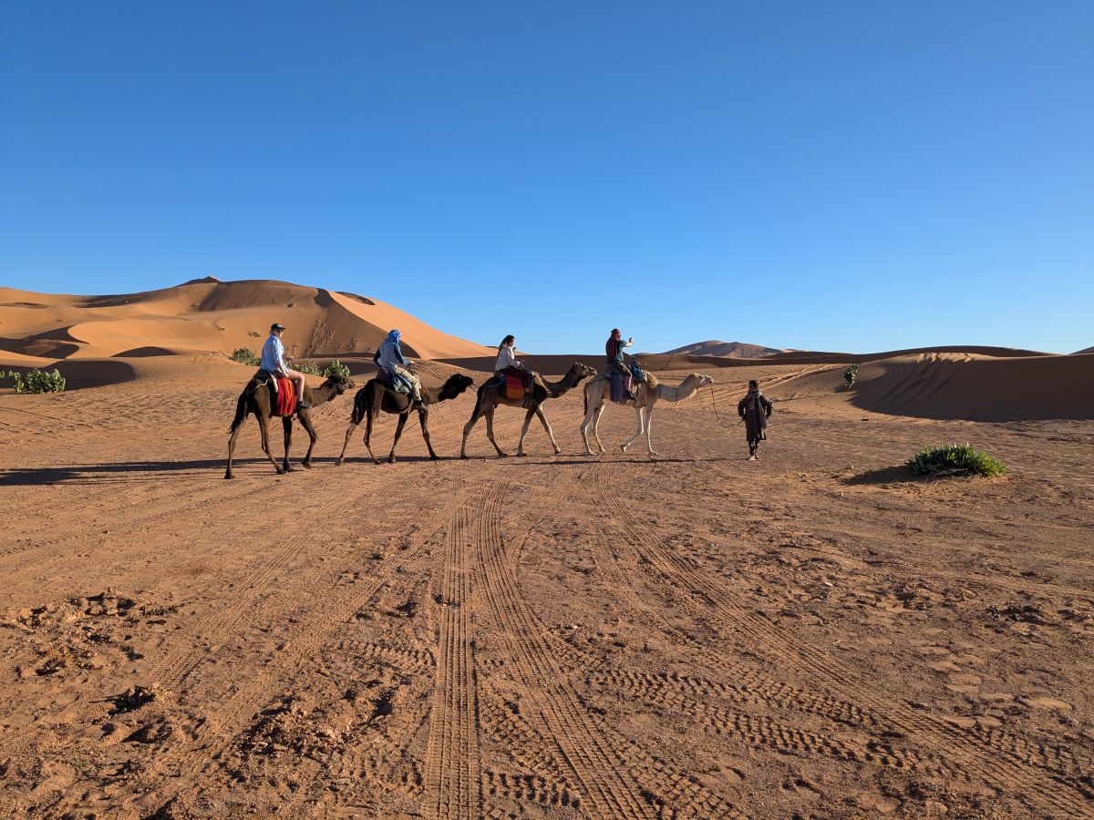
Camel rides are a popular tourist attraction.
The vast dune fields seen at sunset.
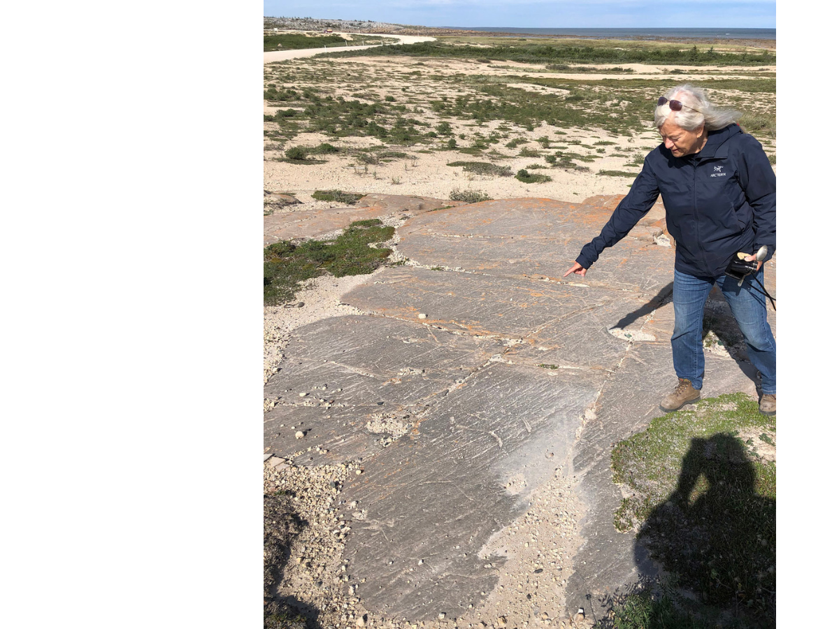
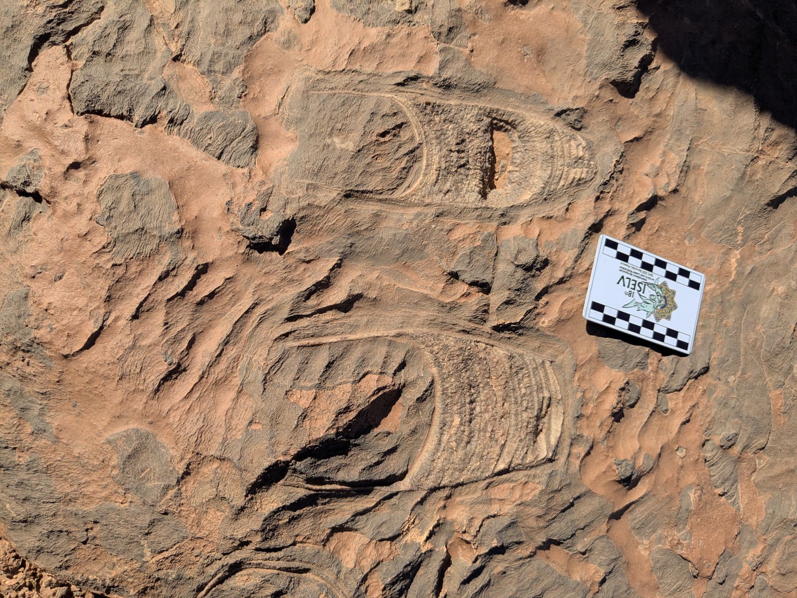
The following day we were guided to two Devonian sites by local expert Moha Mezane. Mezane was first fascinated by fossils close to his home as a young boy and his keen eye for significant finds led to a number of important research contributions. His house also boasts an impressive display of fossils of all ages, ranging from trilobites and fish to ancient whale teeth and fossil trackways. Mezane led us into the desert near his house to a small outcrop featuring incredible trace fossils including trilobite trackways, fish swimming traces, and various invertebrate burrows. Further out, near El Atrous, we saw limestone beds tilted upright at an impressive angle. Scaling the piles of sand up to the exposed rock surfaces was a challenge, but well worth the effort. At the top we were greeted by partial skeletons of Alienacanthus and the shark Maghriboselache mohamezanei (named after Mezane). Such remains of sharks are particularly rare, since excepting their teeth, their skeletons are composed primarily of cartilage which is less resistant to decay than bone. The fossils were well-weathered by the desert wind and sand – it took a keen eye to spot them – but they still had many recognizable anatomical details. After wrapping up here, we finished the day with a very long, bumpy, off-road drive to our next hotel. We spent the night at Auberge Camping Oasis El Mharech, which is located in the heart of the dessert – it’s so remote its address is provided as GPS coordinates!
Our group checking out the incredible collections at Moha Mezane’s house. Image courtesy of Jorge Mondéjar Fernández.
Outcrop near El Atrous, with vertically tilted limestone beds featuring numerous fish fossils.
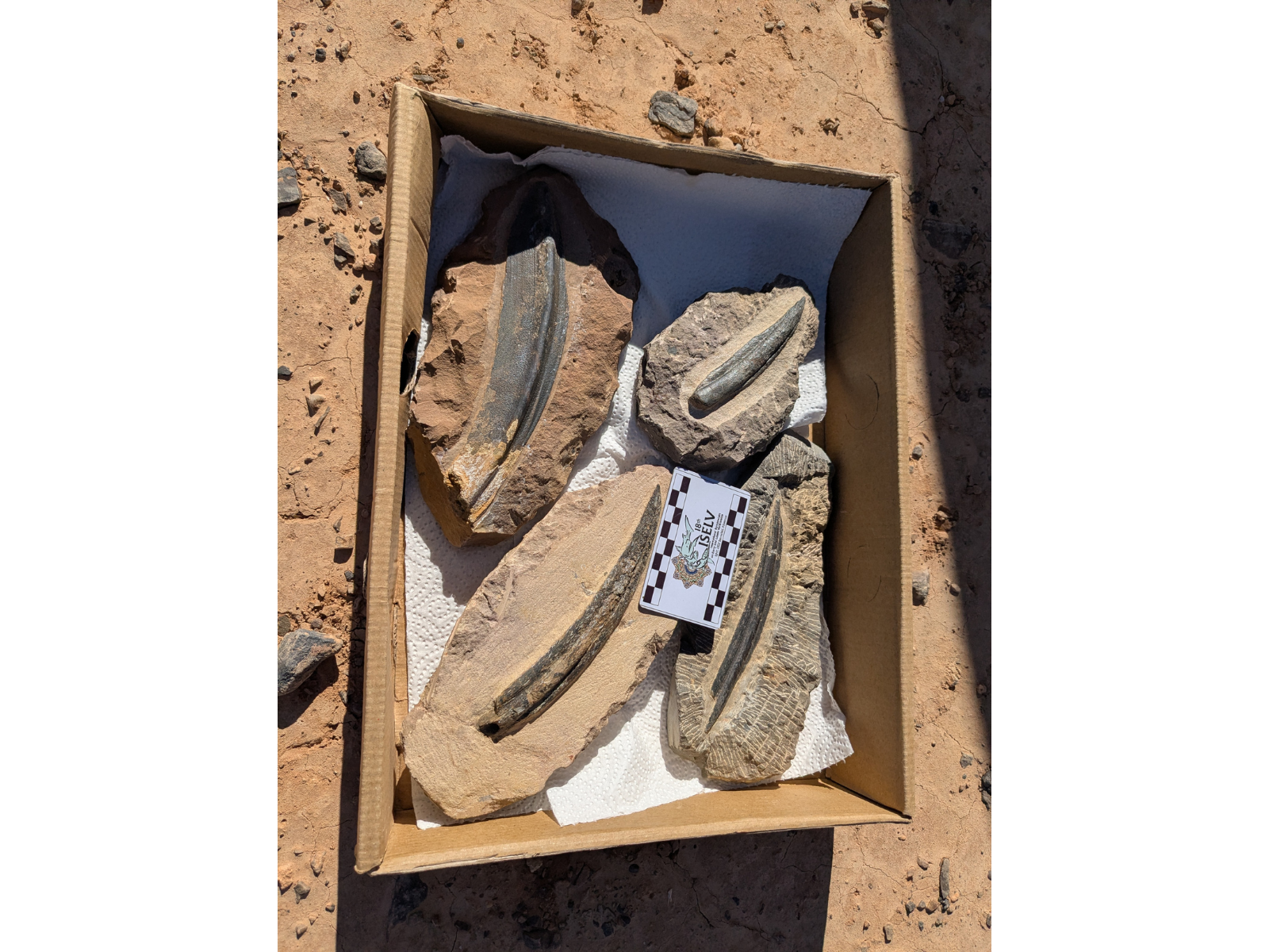
A box containing fin spines from Devonian sharks.
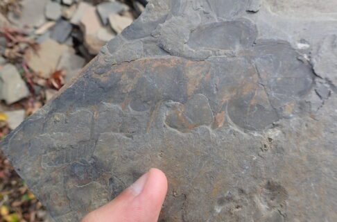
A fossil trackway (Diplichnites) produced by a trilobite. Image courtesy of Jan Fischer.
Jaws, skull, and thoracic armour of Alienacanthus embedded in the outcrop near El Atrous.
Waking early again, we journeyed on into the mountainous region between Tafraoute and El Maharch. Our next stop involved another steep climb to observe a variety of different geological layers, each with its own assortment of fossils. The bottom of the section, around 370 million years old, featured the “thylacocephalan layer,” which is named after the distinctive, extinct, big-eyed crustacean fossils that commonly occur there. The fossils were preserved inside concretions made of reddish ironstone and can be found by splitting open the concretions with a hammer. In addition to the thylacocephalans, rare fossil fishes can be found. One member of our group found an intact fin from a shark. Further up the slope, we crossed into different rock layers containing abundant cephalopods, brachiopods, and pieces of the bony armour of Dunkleosteus. The top of the section featured a distinctive black shale consisting of sediment laid down 359 million years ago during a major extinction pulse (the Hangenberg event), characterized by widespread depletion of oxygen in the oceans, which wiped out placoderm fish and a range of other groups of organisms at the tail end of the Devonian Period. Pondering this dramatic shift in environment which fundamentally reshaped life on Earth seemed a fitting way to conclude our desert explorations.
Fossilized shark fin, probably Maghriboselache, showing traces of the radially arranged rods (originally made of cartilage) that supported the fin at the top and a larger basal support that connected to the body toward the bottom. Image courtesy of Jan Fischer.
Dunkleosteus painting on the wall at Saïd Oukherbouch’s house.
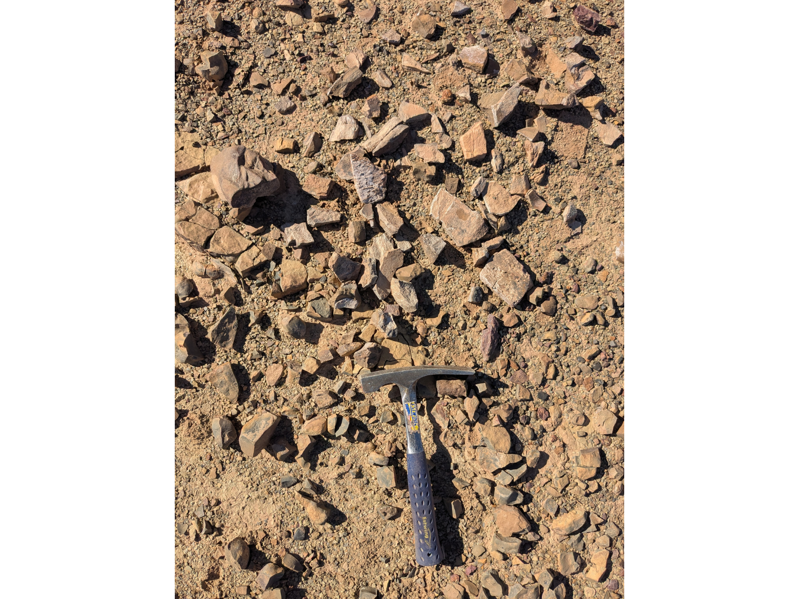
Numerous fragments of Dunkleosteus bone, identified by their bluish colour and striated pattern compared to the reddish surrounding rock. Hammer for scale.
After another long ride back to the road, we had the opportunity to see the personal collection of another significant local collector, Saïd Oukherbouch from Tafraoute, showcasing many intact shark and placoderm fossils found in this area. After taking in the sights here, it was time to begin our long journey back across the Atlas Mountains towards home.