By Dr. Graham Young, past Curator of Palaeontology & Geology
The Deep History of the Churchill Quartzite
As we pass through life we accumulate scars, each of which tells a story about an event that affected us. This white line on my hand shows where I fell hard on a tree stump in Nova Scotia when I was 19 years old. That pain in my ankle reminds me of an injury from another fall 30 years later, on an oil-slicked seashore. The older we get, the more of these old scars and injuries we will accumulate.
It is the same in the natural world. Very old natural things, whether they are living or inanimate, carry many sorts of evidence with them. In the case of rocks, this evidence can tell us the stories of all the events that affected a rock between the time it was formed and the present day.
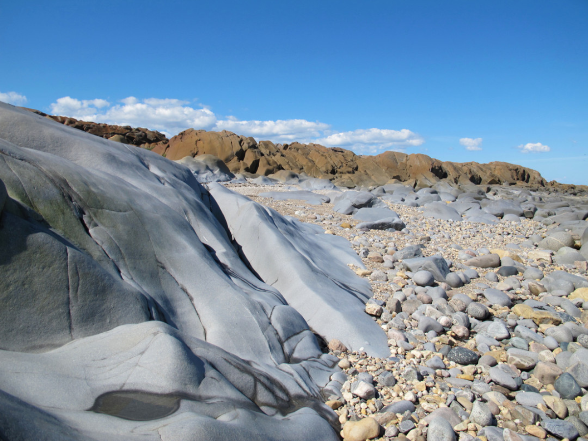
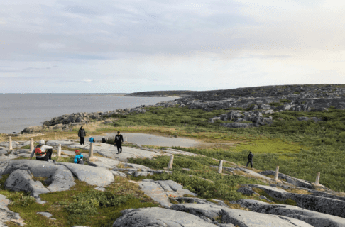
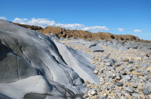
Manitoba is home to many very old rocks; at least 2/3 of our province has bedrock that is about 1.7 to 3.5 billion years old, dating from the mid part of Precambrian time. Many of these rocks are beautiful and memorable – consider examples such as the granites and schists of the Whiteshell, east of Winnipeg – but to my eye the most memorable is the Churchill quartzite. This is the blue-grey to dove grey stone that forms the sculptural, sinuous “whaleback” ridges on both sides of the mouth of the Churchill River near Hudson Bay, so often seen as the backdrops in photos of polar bears.
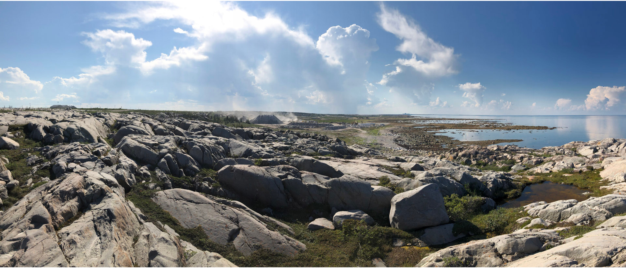
The Churchill quartzite has long been remarked upon by visitors to the Churchill area. It was first described and named by the Geological Survey of Canada geologist Robert Bell in 1880, and though the name “Churchill quartzite” was assigned so long ago, it has never received a formal scientific description, so the word ”quartzite” is not capitalized.
The first waypoint of Churchill quartzite’s time travel was its formation. Although it is a “youngster” in comparison with some of the Precambrian rocks east of Lake Winnipeg, it is still deeply old. Somewhere around 1.8 billion years ago, what is now the Churchill area was covered by large rivers that flowed from newly rising mountains nearby. Since the riverbeds were steeply sloped, the rivers carried an abundance of coarse sediment: quartz grains, dark minerals such as mica and magnetite, and fragments of various rocks (some of which could be quite large).
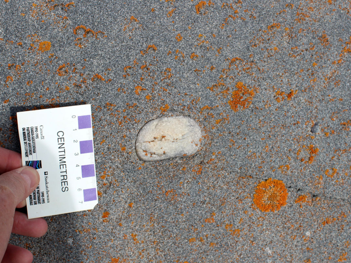
The Churchill quartzite is a metagreywacke, a metamorphosed “dirty sandstone” that can contain large rock fragments such as the rounded white piece in the middle of this photo.
Where the flow of those rivers slowed, they deposited sediment. The Churchill quartzite contains evidence that it was deposited by flowing water, and that the flow was variable: features known as cross beds were formed as the sediment was laid down on angled or curved surfaces, in places such as river sandbars. Over long intervals of time, this deposited material was buried in more sediment, and pressure from the weight of that sediment turned it to stone. The sand, varied minerals, and rock fragments formed a dirty sandstone, known geologically as a greywacke.
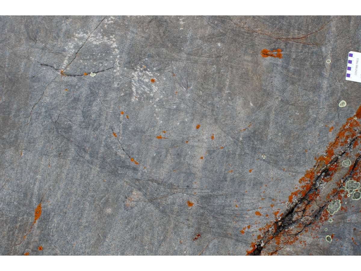
Beautiful trough cross beds can be seen in the Churchill quartzite at Sloop Cove. The dark lines show where grains of heavy minerals such as magnetite were the first to fall out of the water as river flow slowed.
Through yet more geological time, this greywacke was buried ever deeper, where it was subjected to heat and pressure from the ongoing geological activity in this region. This welded the sediment grains together, giving the rock the remarkable toughness for which it is prized today by people building railways and airports. The greywacke had been metamorphosed and became a metamorphic (changed) rock, the metagreywacke that we call the Churchill quartzite.
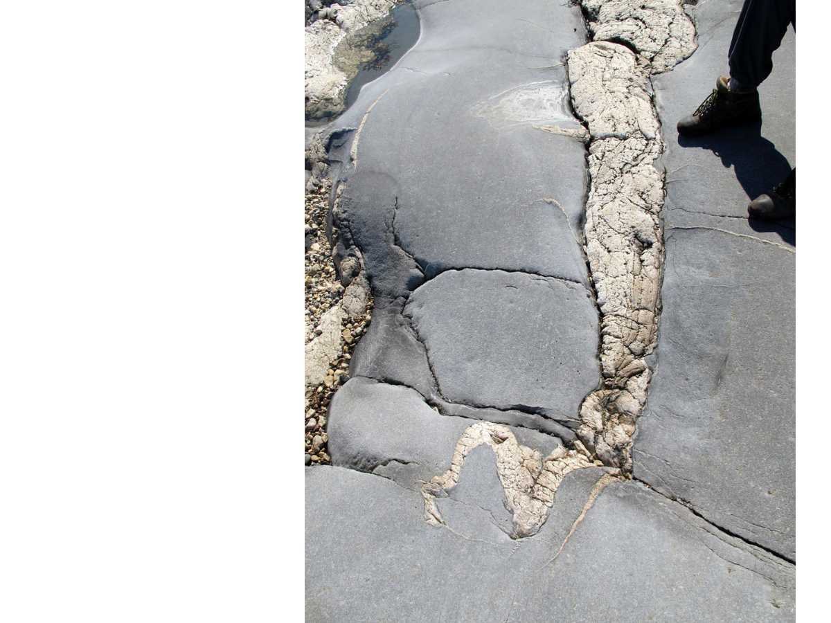
Twisted quartz veins in the Churchill quartzite show that it was subjected to great heat and pressure.
As time continued to pass, the nearby mountains were worn flat by erosion, and the tough, deeply buried Churchill quartzite was slowly uplifted until it was again exposed at the Earth’s surface. For many millions of years, this bedrock was subject to the forces of erosion in a desert-like landscape; the rock surfaces were smoothed and weathered, and large boulder fields developed at the bases of quartzite slopes.
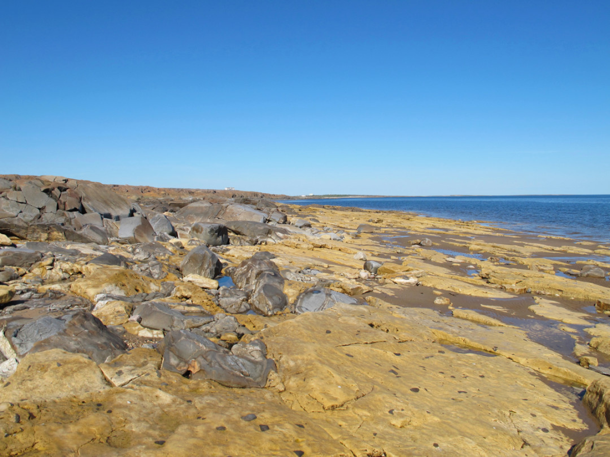
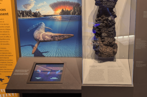
Dolostone from the Ordovician Period was deposited around an ancient boulder field, at the foot of a scarp of Churchill quartzite. The old quartzite island was to the left in this photo, and the Ordovician sea was to the right. This is the site depicted in the Museum’s Ancient Seas exhibit.
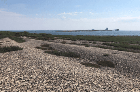
More than a billion years after the Churchill quartzite was formed, another waypoint was added to its time journey. The Churchill region was now near the equator, and a warm sea flowed in and covered the area. Water extended to the horizon in all directions, but the tough ridges of quartzite stood up above the water, so that they formed an archipelago of islands in that tropical sea.
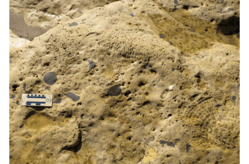
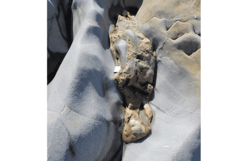
Around these islands, abundant sea life lived: creatures such as trilobites and giant cephalopods swam in the water, while corals proliferated in front of and against the quartzite shores. We see evidence of this sea life in Ordovician and Silurian age dolostones (rocks similar to limestones) and sandstones that date from about 450 to 440 million years ago; in some remarkable instances the fossil-rich rocks fill crevices in the quartzite surfaces!
The sea became deeper, and during the Silurian and the subsequent Devonian Period, it is likely that the sculpted ridges of Churchill quartzite were again buried, with hundreds of metres of sedimentary rock laid down above them. An immense length of time passed, hundreds of millions of years, the sea was gone, and the thick sedimentary rocks above the quartzite were slowly eroded away by water and wind.
About two and a half million years ago, a different erosional force arrived in the region. The Ice Age, also known as the Pleistocene glaciation, began, and large continental glaciers began to expand southward from the Arctic. These glaciers eventually covered much of North America, and in places they were two to four kilometres thick! The immense weight of this great thickness of ice gave it immense erosional power, and as it moved slowly southward across the land surface it deeply eroded and scoured the bedrock surfaces.
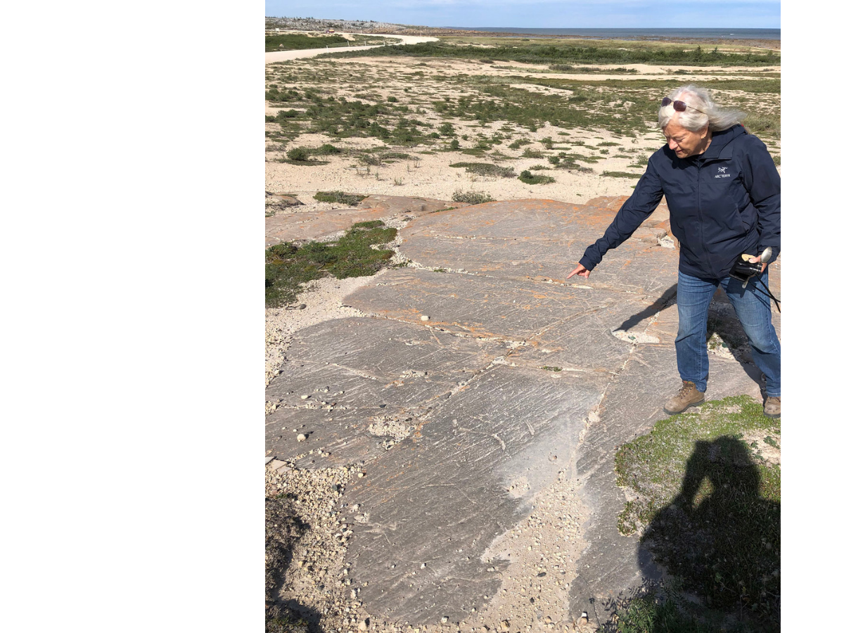
Striations on a polished quartzite surface show the direction(s) of glacial ice movement. Here, Dr. Maureen Matthews demonstrates striations east of Churchill Airport.
As was the case during earlier erosion intervals, the immense toughness of the Churchill quartzite meant that it fared better than the other rocks around it. The dolostones that overlaid and abutted the quartzite were heavily ground down, to the extent that they can be observed in only a few select places in the Churchill area. The quartzite ridges themselves, in spite of their hardness, show considerable evidence of glacial erosion: in most places their surfaces were polished by the ice and show striations, lines and grooves that demonstrate the varied directions of ice flow as the rock fragments stuck into the bottom of the glacier scraped the top of the bedrock.
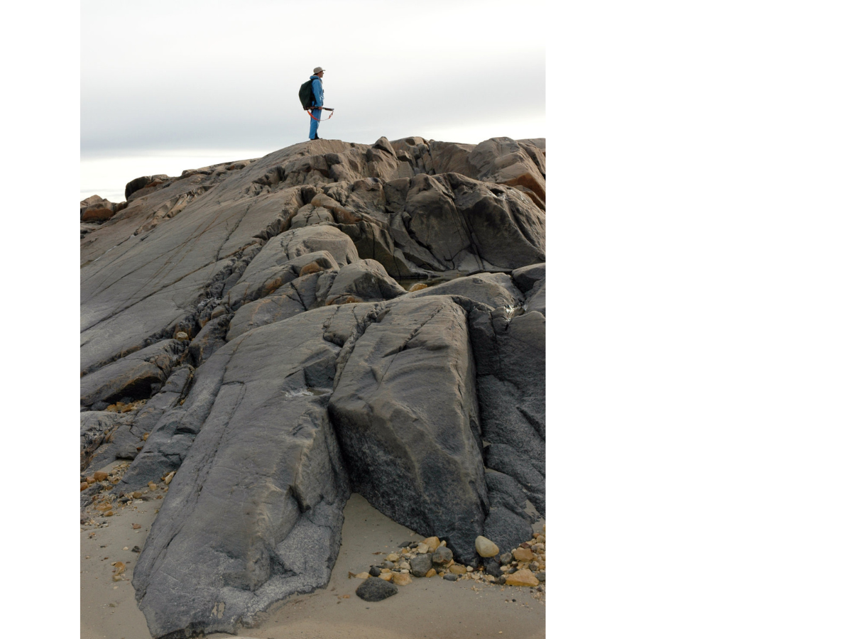
East of Halfway Point, the quartzite ridge along the shore has the features of a roche moutonée: it is curved and polished on the north side (left), while the south side (right) shows many places where pieces of the rock were plucked and carried away by the flowing glacier.
In some locations you can see other features characteristic of glacial erosion: a roche moutonnée, or sheepback, shows where a large chunk was plucked out of the downstream side of a quartzite ridge, while the upstream side of the same ridge was smoothly polished. Chatter marks are smaller features, crescent-shaped gouges that show evidence of chipping by rock fragments on the base of the glacier; these are typically at right angles to the direction of ice flow (which is itself demonstrated by the striations, or lines on the bedrock surface).
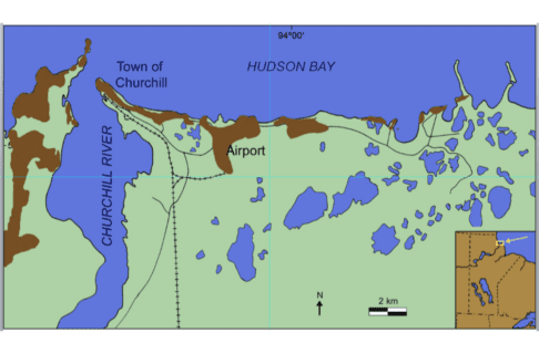
In southern Canada the Ice Age began to end roughly 12,000 years ago, and by 8,000 years ago the ice in northern Manitoba had melted to the extent that the Tyrrell Sea had formed – this forerunner of Hudson Bay was a huge body of water that covered the low-lying land that had been pushed down by the weight of the glaciers. Our ridges of Churchill quartzite were now again under deep salt water; old beach ridges show that the Tyrrell Sea extended many tens of kilometres south and west of Churchill.
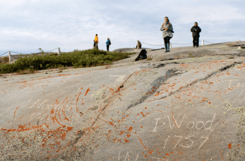
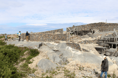
This region has been rising ever since, and even today the Churchill area continues to rise at a rate of almost a metre a century! This continued uplift is shown by the relationship between some human structures and the quartzite ridges. For example, old mooring rings at Sloop Cove, near the Churchill River, show where people were able to haul sloops (small ships) out of the river in the 18th century, to protect them from ice during the long northern winter. The cove has risen so much in the past 300 years that there is no way a ship could be hauled out in the same place today!
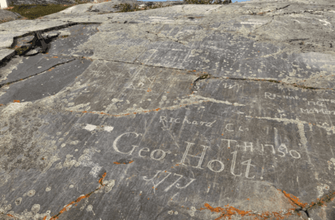
Sloop Cove is one piece of the final chapter in the saga of the Churchill quartzite. The sinuous ridges have actually been associated with humanity for several millennia, ever since Pre-Dorset Inuit people living some 3500 years ago hunted marine mammals from what was then an archipelago of quartzite islands in the Tyrrell Sea. More recently, the men of the Hudson’s Bay Company quarried large blocks of this tough stone for construction of the impressive 18th century Fort Prince of Wales and Cape Merry Battery, which flank either side of the mouth of the Churchill River. Those men also carved the names of many men and ships into the cross-bedded quartzite at Sloop Cove.
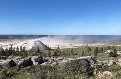
In the 20th and 21st centuries, Churchill quartzite has been put to many uses by enterprising humans: it makes superb ballast stone for the Hudson Bay Railway, it has been used to construct the large weir that controls flow of the Churchill River, it underlies the runways of Churchill Airport, and it appears as a backdrop in all those wonderful photos and videos of polar bears in their natural habitat!
What does the future hold, I wonder, for such a remarkable and robust geological formation? In any case, it will be here for many millennia to come.
This post draws on images and observations from our very successful August, 2022, Museum research trip to the Churchill area, which allowed our group to develop many ideas for new exhibit collaborations. A few of the photos are from earlier paleontological fieldwork in the Churchill area over the past 26 years.


