

Posted on: Tuesday October 7, 2014
By Dr. Graham Young, past Curator of Palaeontology & Geology
Travels in the Hudson Bay Lowlands, August, 2014
Manitoba is an immense place, very slightly larger than France. If you look at the map, you will see that roads here are concentrated in the southernmost part of the province. The farther north you go, the fewer areas you will find that are easy to visit. Those of us who work in field-based sciences occasionally get to some of the more out-of-the way places, but most of us have still seen only a small fraction of what this province has to offer. The Manitoba landscapes that are familiar to us are either the parts that we have seen (such as the prairies and the big lakes), or those that are regularly depicted in photographs and tourist brochures (such as a few places in the boreal forest and the rocky shoreline around Churchill).
This fact was really brought home to me during the last week of August, as I was invited to participate in some northern fieldwork organized by my colleagues at the Manitoba Geological Survey. I have seen a good few parts of southern and central Manitoba, but in the northern third of the province I really only know the Churchill area. Nevertheless, I thought I had a good feel for what the areas away from Churchill might be like. Our plan for this trip was to visit some of the geological sites in the Churchill area, but also to take advantage of funding support for helicopter time, which would allow us to visit a few places far up the Churchill River, 100 kilometres from any road and far from the Hudson Bay Railway.
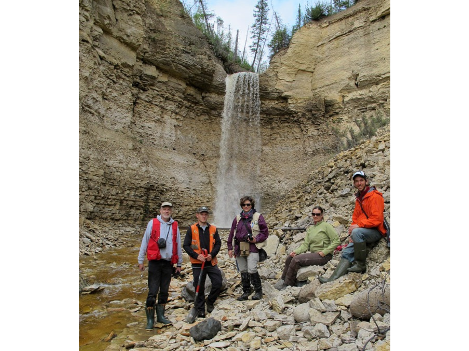
Visiting the waterfall at Surprise Creek, near the Churchill River. L-R: Me, Daniel Shaw (Manitoba Geological Survey), Michelle Boulet Nicolas (MGS), Michelle Trommelen (MGS), and Daniel Gibson (Churchill Northern Studies Centre). Photo by our helicopter pilot, Frank Roberts
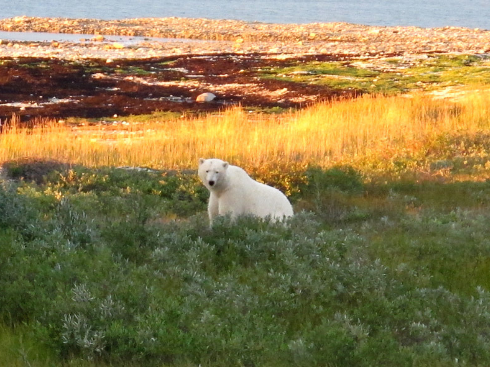
The “standard” image of Churchill: a polar bear in coastal vegetation.
The helicopter travel turned out to be an eye-opening experience. The up-river sites had received some study from scientists working with the Geological Survey of Canada, who visited this area 50 to 60 years ago, so I knew something of what I would see in terms of the rocks and fossils: the bedrock exposures are very good, and many of the fossils are superb (though they are not generally as abundant as I had anticipated).
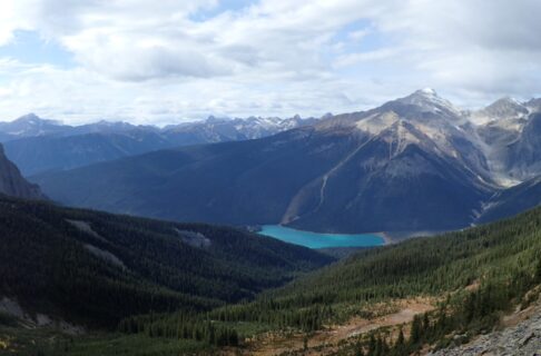
More than a decade ago we had overflown a few of these up-river sites when we had a bit of helicopter time in Churchill, so I should have really known what it would be like there, but seeing them from the ground was quite different. The Churchill River landscape has a tremendous sweep and grandeur. The river is very wide and flows swiftly, sometimes in an almost straight line, more often with gentle bends. Some downstream areas have bars of gravel and cobbles, but farther upstream there are several sets of treacherous-looking rapids. The valley walls steepen as you travel upstream, from the flat lowlands south of Churchill to a substantial height of land 100 kilometres upstream where the valley walls are cliffs of Ordovician bedrock, resting on the Precambrian granitic rock that makes up the river bed.
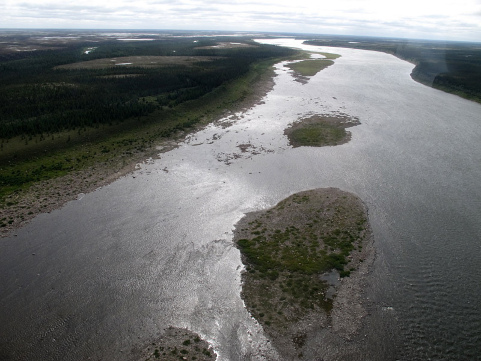
The lower Churchill River is huge!
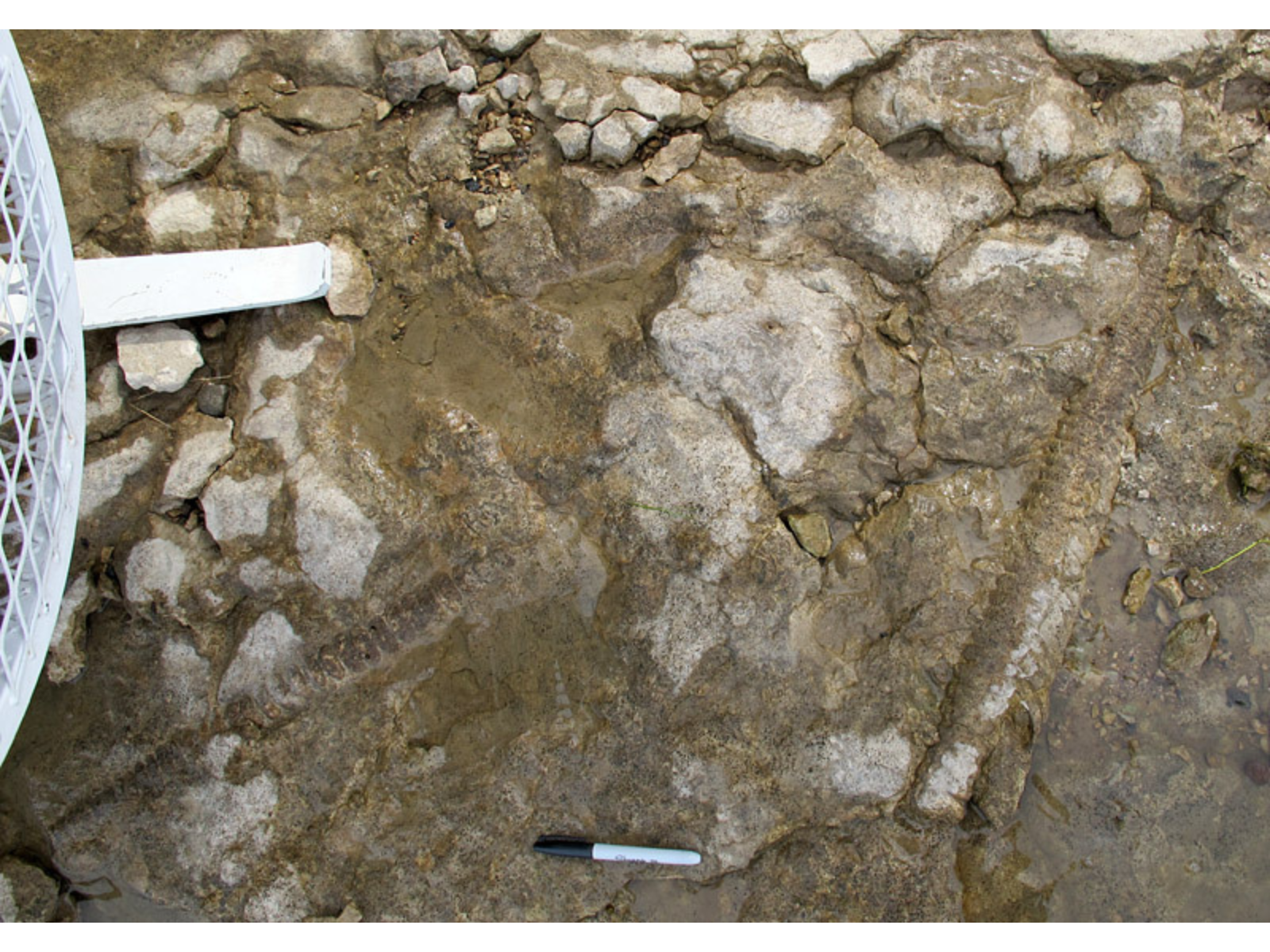
A few of the fossils we found: these Ordovician age cephalopods were in the Chasm Creek Formation below Red Head Rapids on the Churchill River (one of these is now in the collections of the Museum). That’s the helicopter skid on the left; we had landed directly on the outcrop.
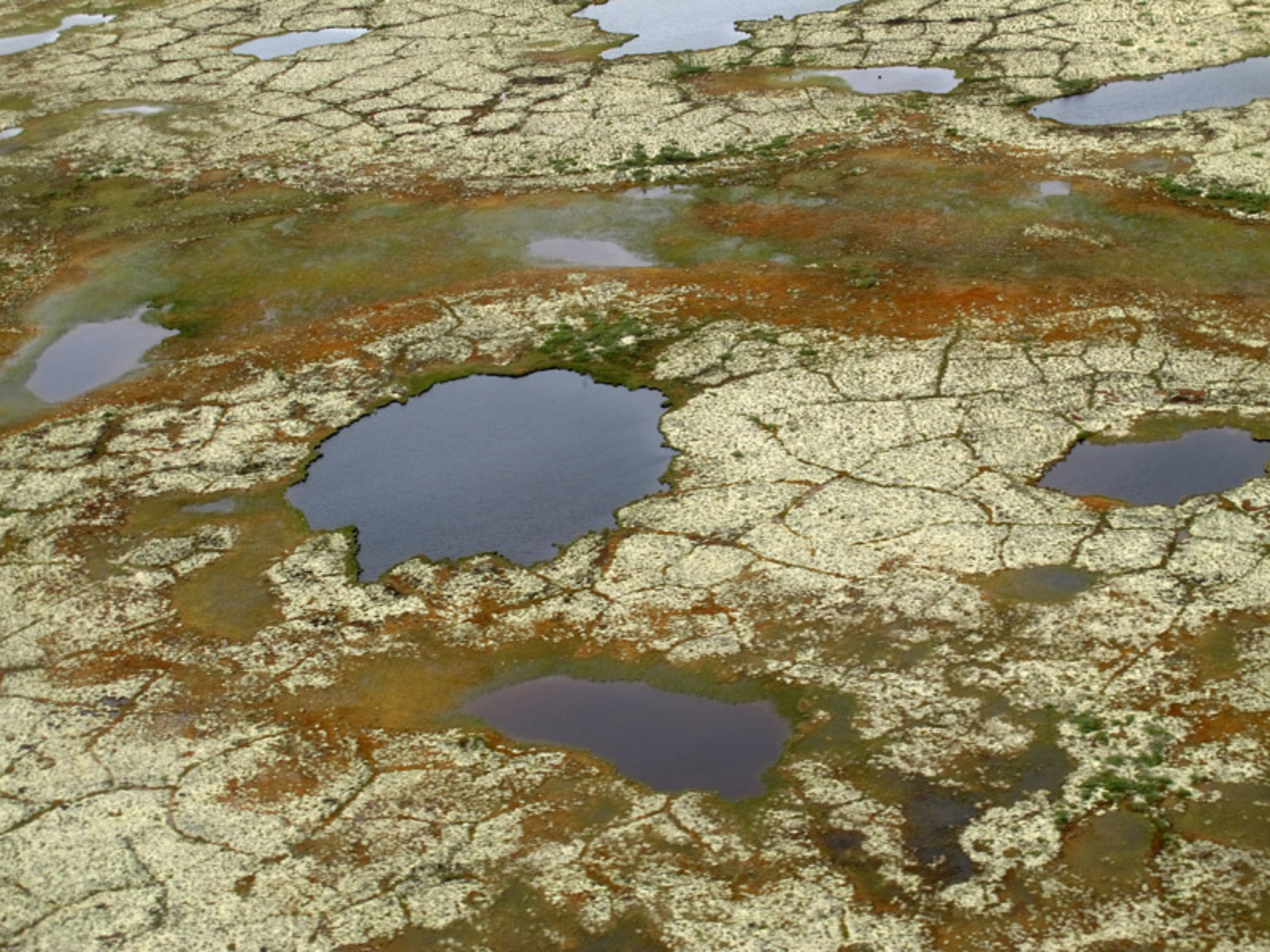
Up over the tundra the landscape is dramatically different: this is an aerial view of moss and ponds, from a height of a few hundred feet.
Portage Chute, Bad Cache Rapids, Surprise Creek, Caution Creek, Chasm Creek . . . the place names alone should be enough to tell you that you aren’t on the prairies any more. Honestly, if I had been somehow sedated and delivered into the ravine of Chasm Creek without any awareness of how I arrived there, I would have thought that it had to be somewhere in the Yukon or perhaps the Northwest Territories.
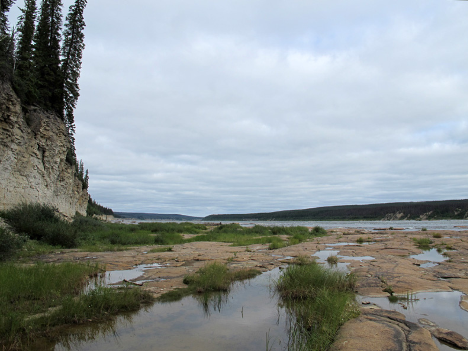
A river-level view just below Portage Chute.
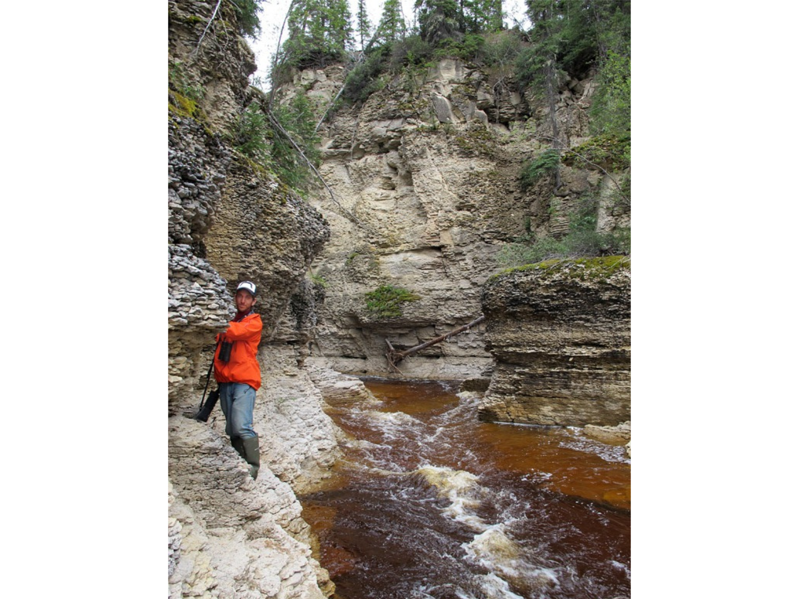
Daniel Gibson at Chasm Creek.
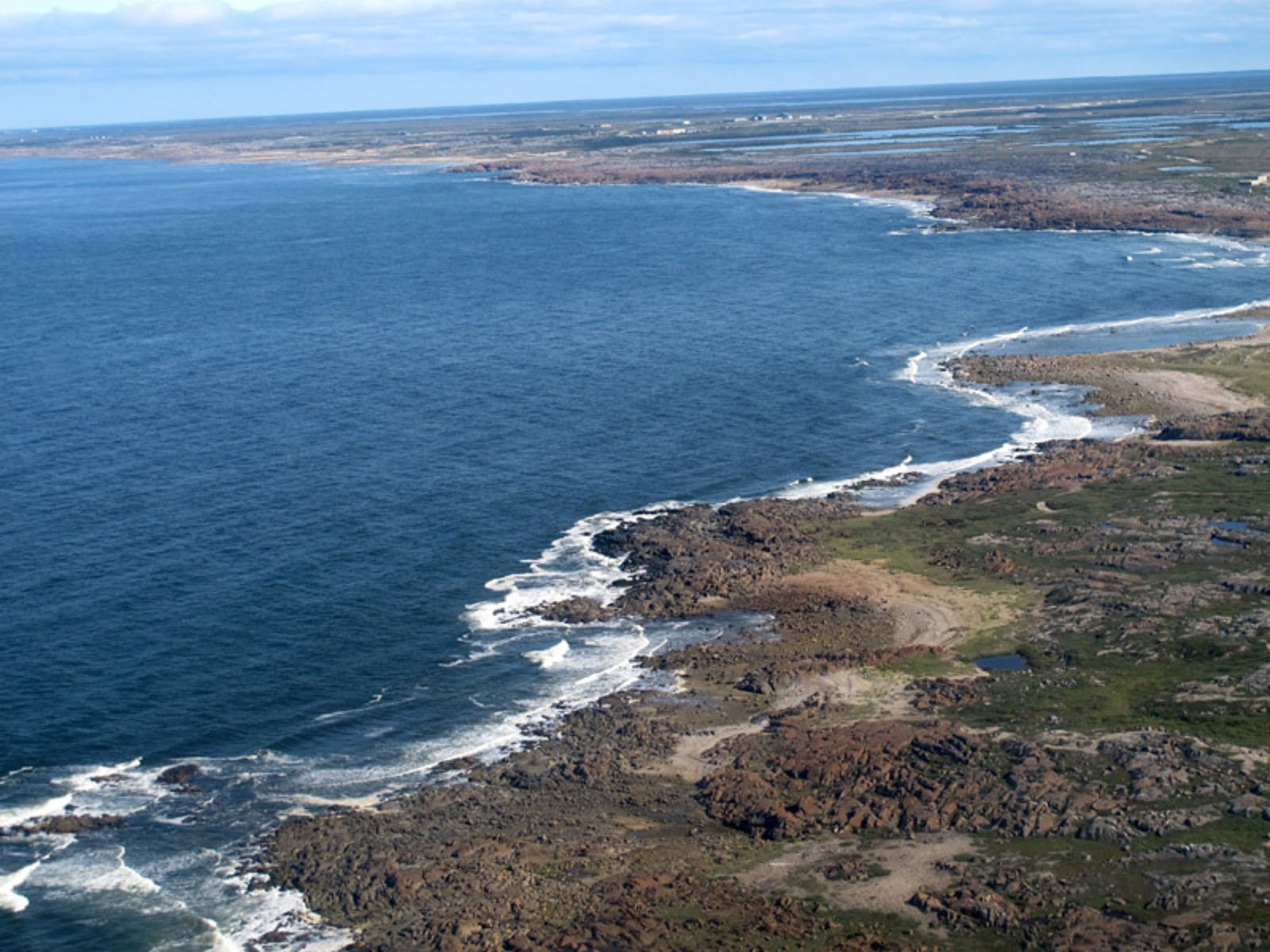
A more familiar place as we flew “homeward” near the end of the day: a view back along the coast of Hudson Bay toward the Churchill Northern Studies Centre.
The valley of the Churchill River is a literally awesome place, breathtaking in its grandeur, its scale, and in the variety of landforms and organisms. It is absolutely a northern place, a place that Manitobans should be aware of, a place to celebrate!